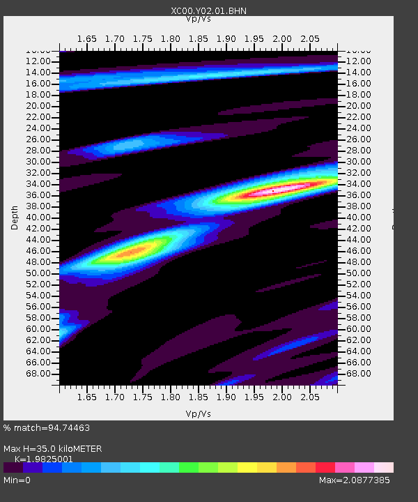
Y02 Y02 - Earthquake Result Viewer
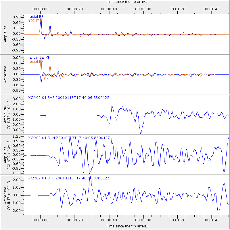
Earthquake location: El Salvador
Earthquake latitude/longitude: 13.0/-88.7
Earthquake time(UTC): 2001/01/13 (013) 17:33:32 GMT
Earthquake Depth: 60 km
Earthquake Magnitude: 6.4 MB, 7.8 MS, 7.7 MW, 7.5 ME
Earthquake Catalog/Contributor: WHDF/NEIC
Network: XC Yellowstone Intermountain Seismic Array
Station: Y02 Y02
Lat/Lon: 44.07 N/112.64 W
Elevation: 1532 m
Distance: 37.1 deg
Az: 330.969 deg
Baz: 138.996 deg
Ray Param: 0.076142505
Estimated Moho Depth: 35.0 km
Estimated Crust Vp/Vs: 1.98
Assumed Crust Vp: 6.577 km/s
Estimated Crust Vs: 3.317 km/s
Estimated Crust Poisson's Ratio: 0.33
Radial Match: 94.74463 %
Radial Bump: 266
Transverse Match: 81.93995 %
Transverse Bump: 400
SOD ConfigId: 16820
Insert Time: 2010-02-26 15:03:33.643 +0000
GWidth: 2.5
Max Bumps: 400
Tol: 0.001

Signal To Noise

ChannelStoNSTALTA
XC:Y02:01:BHN:20010113T17:40:06.830012Z1.14644251.4473407E-51.2624625E-5
XC:Y02:01:BHE:20010113T17:40:06.830012Z0.654911041.8790231E-52.8691273E-5
XC:Y02:01:BHZ:20010113T17:40:06.830012Z1.03261893.9680137E-53.84267E-5
Arrivals
Ps5.6 SECOND
PpPs15 SECOND
PsPs/PpSs20 SECOND