Y01 Y01 - Earthquake Result Viewer
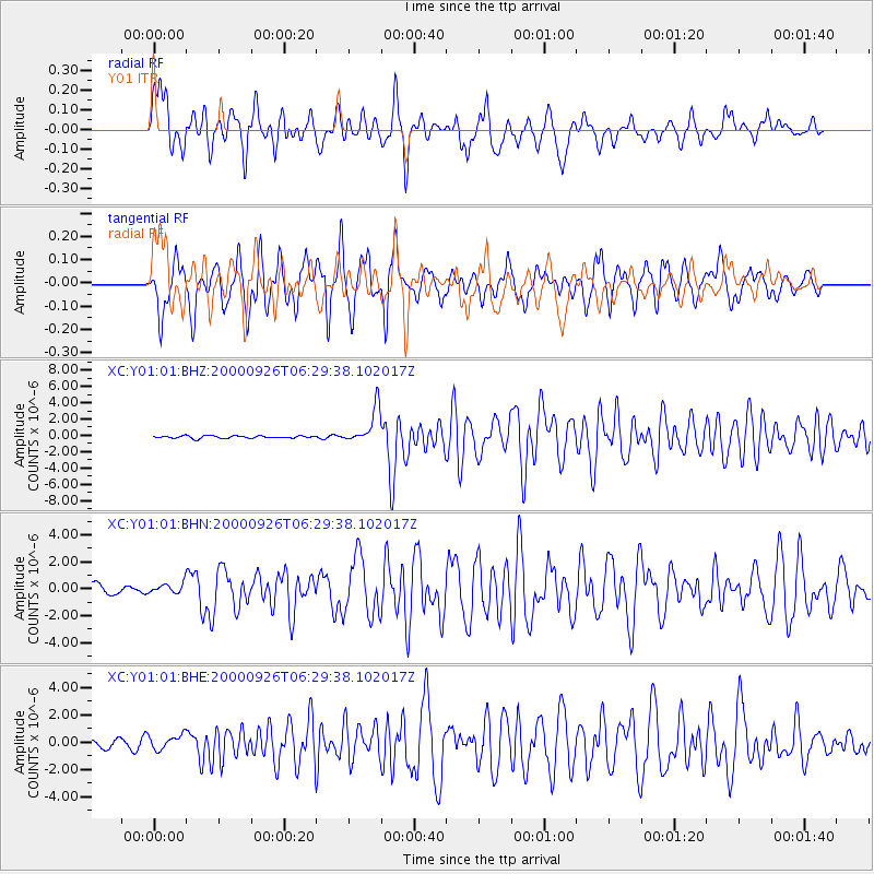
Earthquake location: Tonga Islands
Earthquake latitude/longitude: -17.2/-173.9
Earthquake time(UTC): 2000/09/26 (270) 06:17:52 GMT
Earthquake Depth: 56 km
Earthquake Magnitude: 6.1 MB, 6.1 MS, 6.4 MW, 6.1 ME
Earthquake Catalog/Contributor: WHDF/NEIC
Network: XC Yellowstone Intermountain Seismic Array
Station: Y01 Y01
Lat/Lon: 44.39 N/113.17 W
Elevation: 2099 m
Distance: 82.5 deg
Az: 39.124 deg
Baz: 237.279 deg
Ray Param: 0.04672774
Estimated Moho Depth: 63.25 km
Estimated Crust Vp/Vs: 2.05
Assumed Crust Vp: 6.577 km/s
Estimated Crust Vs: 3.216 km/s
Estimated Crust Poisson's Ratio: 0.34
Radial Match: 85.617744 %
Radial Bump: 400
Transverse Match: 85.977425 %
Transverse Bump: 397
SOD ConfigId: 16820
Insert Time: 2010-02-26 15:04:00.006 +0000
GWidth: 2.5
Max Bumps: 400
Tol: 0.001

Signal To Noise

ChannelStoNSTALTA
XC:Y01:01:BHN:20000926T06:29:38.102017Z1.18180423.9218503E-73.3185282E-7
XC:Y01:01:BHE:20000926T06:29:38.102017Z2.00403675.395856E-72.6924934E-7
XC:Y01:01:BHZ:20000926T06:29:38.102017Z14.2696052.1707328E-61.5212284E-7
Arrivals
Ps10 SECOND
PpPs29 SECOND
PsPs/PpSs39 SECOND