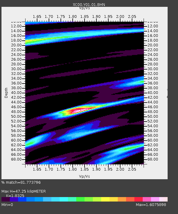
Y01 Y01 - Earthquake Result Viewer
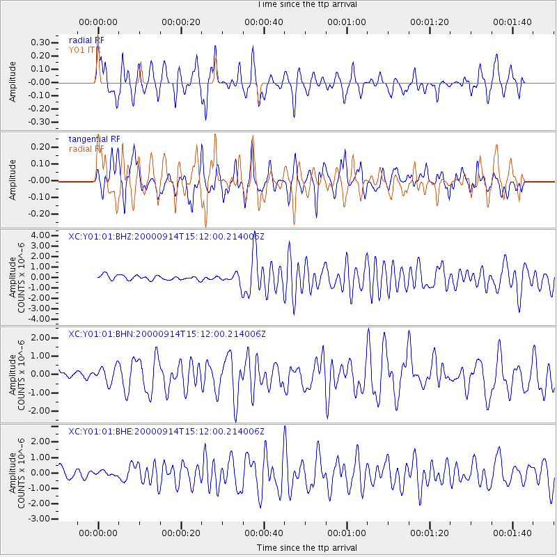
Earthquake location: Fiji Islands
Earthquake latitude/longitude: -15.7/179.8
Earthquake time(UTC): 2000/09/14 (258) 14:59:57 GMT
Earthquake Depth: 33 km
Earthquake Magnitude: 5.7 MB, 6.2 MS, 6.3 MW, 6.2 MW
Earthquake Catalog/Contributor: WHDF/NEIC
Network: XC Yellowstone Intermountain Seismic Array
Station: Y01 Y01
Lat/Lon: 44.39 N/113.17 W
Elevation: 2099 m
Distance: 85.3 deg
Az: 41.48 deg
Baz: 242.822 deg
Ray Param: 0.04479993
Estimated Moho Depth: 47.25 km
Estimated Crust Vp/Vs: 1.83
Assumed Crust Vp: 6.577 km/s
Estimated Crust Vs: 3.589 km/s
Estimated Crust Poisson's Ratio: 0.29
Radial Match: 81.773796 %
Radial Bump: 400
Transverse Match: 74.22467 %
Transverse Bump: 400
SOD ConfigId: 16820
Insert Time: 2010-02-26 15:04:01.312 +0000
GWidth: 2.5
Max Bumps: 400
Tol: 0.001

Signal To Noise

ChannelStoNSTALTA
XC:Y01:01:BHN:20000914T15:12:00.214006Z1.35831984.772002E-73.5131654E-7
XC:Y01:01:BHE:20000914T15:12:00.214006Z0.33633821.3920567E-74.13886E-7
XC:Y01:01:BHZ:20000914T15:12:00.214006Z2.35885175.127809E-72.1738583E-7
Arrivals
Ps6.1 SECOND
PpPs20 SECOND
PsPs/PpSs26 SECOND