Y47 Y47 - Earthquake Result Viewer
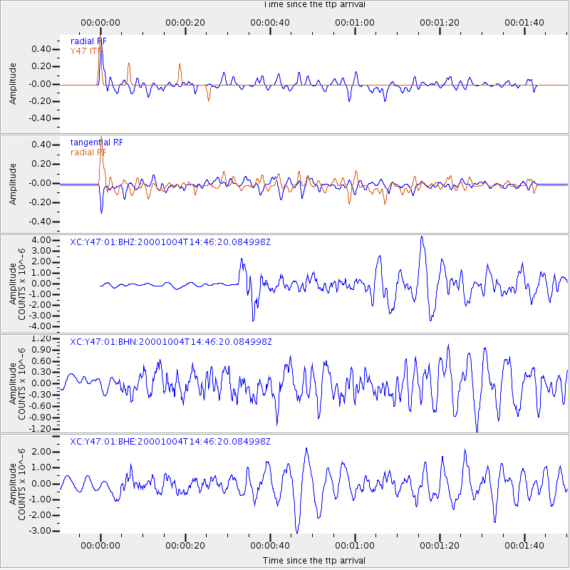
Earthquake location: Windward Islands
Earthquake latitude/longitude: 11.1/-62.6
Earthquake time(UTC): 2000/10/04 (278) 14:37:44 GMT
Earthquake Depth: 110 km
Earthquake Magnitude: 5.6 MB, 5.4 MS, 6.1 MW, 5.9 MD
Earthquake Catalog/Contributor: WHDF/NEIC
Network: XC Yellowstone Intermountain Seismic Array
Station: Y47 Y47
Lat/Lon: 45.99 N/110.04 W
Elevation: 1644 m
Distance: 53.1 deg
Az: 320.042 deg
Baz: 115.295 deg
Ray Param: 0.065937676
Estimated Moho Depth: 22.5 km
Estimated Crust Vp/Vs: 1.66
Assumed Crust Vp: 6.35 km/s
Estimated Crust Vs: 3.82 km/s
Estimated Crust Poisson's Ratio: 0.22
Radial Match: 81.17411 %
Radial Bump: 400
Transverse Match: 82.292694 %
Transverse Bump: 400
SOD ConfigId: 16820
Insert Time: 2010-02-26 15:04:08.624 +0000
GWidth: 2.5
Max Bumps: 400
Tol: 0.001

Signal To Noise

ChannelStoNSTALTA
XC:Y47:01:BHN:20001004T14:46:20.084998Z0.88204052.2014217E-72.4958285E-7
XC:Y47:01:BHE:20001004T14:46:20.084998Z2.2271075.544819E-72.4896957E-7
XC:Y47:01:BHZ:20001004T14:46:20.084998Z6.5478969.924373E-71.5156584E-7
Arrivals
Ps2.5 SECOND
PpPs8.9 SECOND
PsPs/PpSs11 SECOND