
Y43 Y43 - Earthquake Result Viewer
| ||||||||||||||||||
| ||||||||||||||||||
| ||||||||||||||||||
|
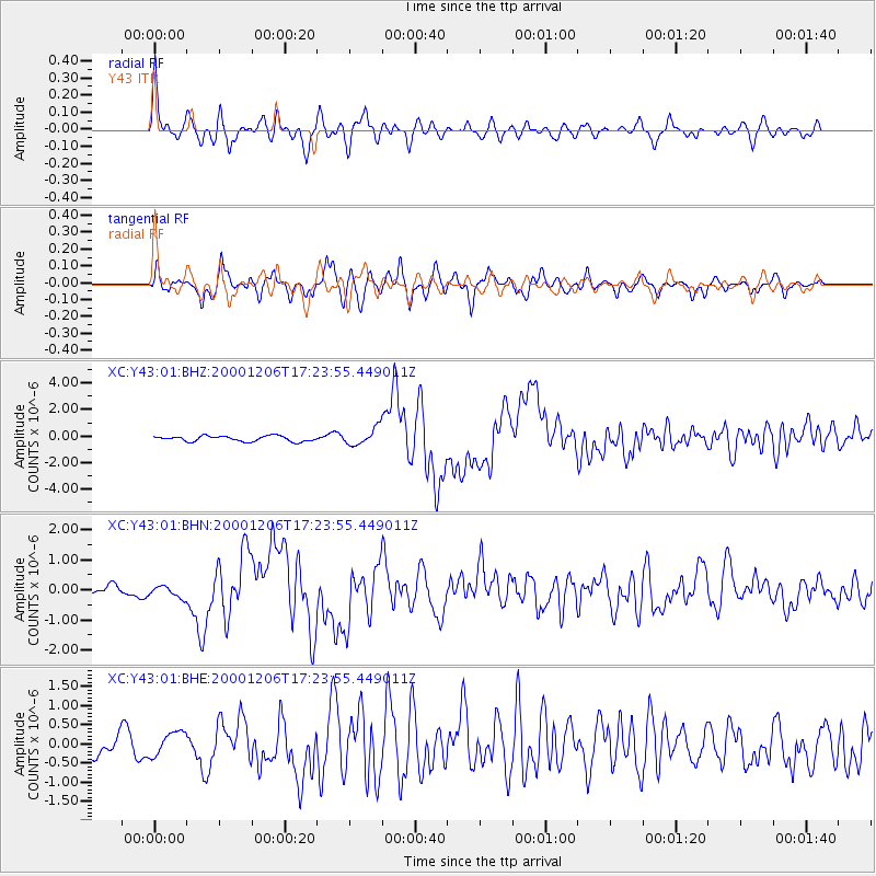
Signal To Noise
| Channel | StoN | STA | LTA |
| XC:Y43:01:BHN:20001206T17:23:55.449011Z | 1.4347223 | 2.4070752E-7 | 1.677729E-7 |
| XC:Y43:01:BHE:20001206T17:23:55.449011Z | 1.5896276 | 3.0027917E-7 | 1.8889907E-7 |
| XC:Y43:01:BHZ:20001206T17:23:55.449011Z | 3.072833 | 6.16999E-7 | 2.0079158E-7 |
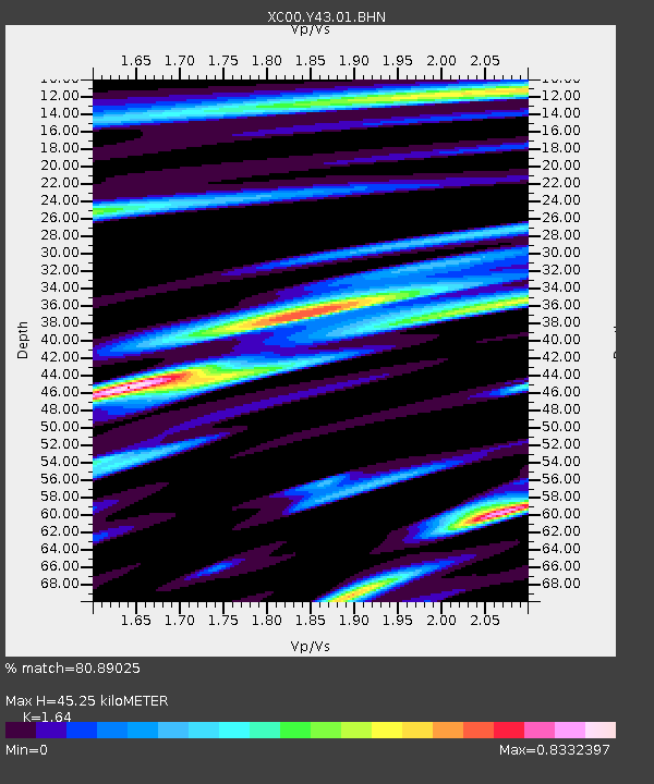
| Arrivals | |
| Ps | 4.7 SECOND |
| PpPs | 19 SECOND |
| PsPs/PpSs | 23 SECOND |

