Y43 Y43 - Earthquake Result Viewer
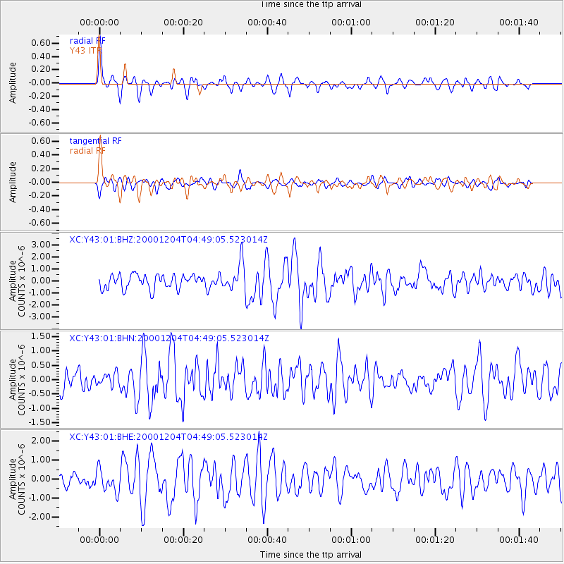
Earthquake location: Near Coast Of Chiapas, Mexico
Earthquake latitude/longitude: 14.9/-93.9
Earthquake time(UTC): 2000/12/04 (339) 04:43:09 GMT
Earthquake Depth: 33 km
Earthquake Magnitude: 5.6 MB, 5.7 MS, 6.0 MW, 5.9 MW
Earthquake Catalog/Contributor: WHDF/NEIC
Network: XC Yellowstone Intermountain Seismic Array
Station: Y43 Y43
Lat/Lon: 44.45 N/109.60 W
Elevation: 1897 m
Distance: 32.3 deg
Az: 338.827 deg
Baz: 150.814 deg
Ray Param: 0.07864177
Estimated Moho Depth: 53.0 km
Estimated Crust Vp/Vs: 1.92
Assumed Crust Vp: 6.242 km/s
Estimated Crust Vs: 3.243 km/s
Estimated Crust Poisson's Ratio: 0.32
Radial Match: 80.67587 %
Radial Bump: 400
Transverse Match: 66.81005 %
Transverse Bump: 400
SOD ConfigId: 16820
Insert Time: 2010-02-26 15:04:21.695 +0000
GWidth: 2.5
Max Bumps: 400
Tol: 0.001

Signal To Noise

ChannelStoNSTALTA
XC:Y43:01:BHN:20001204T04:49:05.523014Z0.64154942.1475199E-73.3473958E-7
XC:Y43:01:BHE:20001204T04:49:05.523014Z1.25030665.993308E-74.793471E-7
XC:Y43:01:BHZ:20001204T04:49:05.523014Z2.084431.1738275E-65.6314076E-7
Arrivals
Ps8.4 SECOND
PpPs23 SECOND
PsPs/PpSs32 SECOND