Y43 Y43 - Earthquake Result Viewer
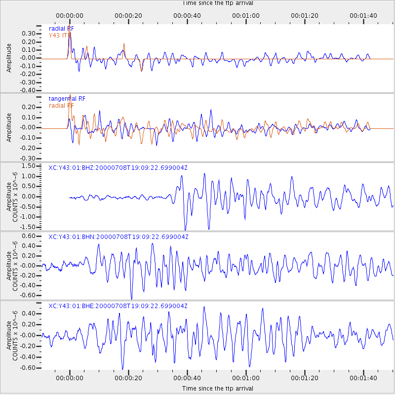
Earthquake location: Near S. Coast Of Honshu, Japan
Earthquake latitude/longitude: 34.1/139.1
Earthquake time(UTC): 2000/07/08 (190) 18:57:44 GMT
Earthquake Depth: 10 km
Earthquake Magnitude: 5.9 MB, 5.6 MS, 6.0 MW, 5.9 MW
Earthquake Catalog/Contributor: WHDF/NEIC
Network: XC Yellowstone Intermountain Seismic Array
Station: Y43 Y43
Lat/Lon: 44.45 N/109.60 W
Elevation: 1897 m
Distance: 80.0 deg
Az: 42.657 deg
Baz: 308.229 deg
Ray Param: 0.048559967
Estimated Moho Depth: 39.5 km
Estimated Crust Vp/Vs: 1.97
Assumed Crust Vp: 6.242 km/s
Estimated Crust Vs: 3.173 km/s
Estimated Crust Poisson's Ratio: 0.33
Radial Match: 80.14104 %
Radial Bump: 400
Transverse Match: 74.52476 %
Transverse Bump: 400
SOD ConfigId: 3744
Insert Time: 2010-02-26 15:04:23.715 +0000
GWidth: 2.5
Max Bumps: 400
Tol: 0.001

Signal To Noise

ChannelStoNSTALTA
XC:Y43:01:BHN:20000708T19:09:22.699004Z1.13042318.820718E-87.803024E-8
XC:Y43:01:BHE:20000708T19:09:22.699004Z0.960172837.3117164E-87.615001E-8
XC:Y43:01:BHZ:20000708T19:09:22.699004Z0.957788055.7520786E-86.005586E-8
Arrivals
Ps6.3 SECOND
PpPs18 SECOND
PsPs/PpSs25 SECOND