Y43 Y43 - Earthquake Result Viewer
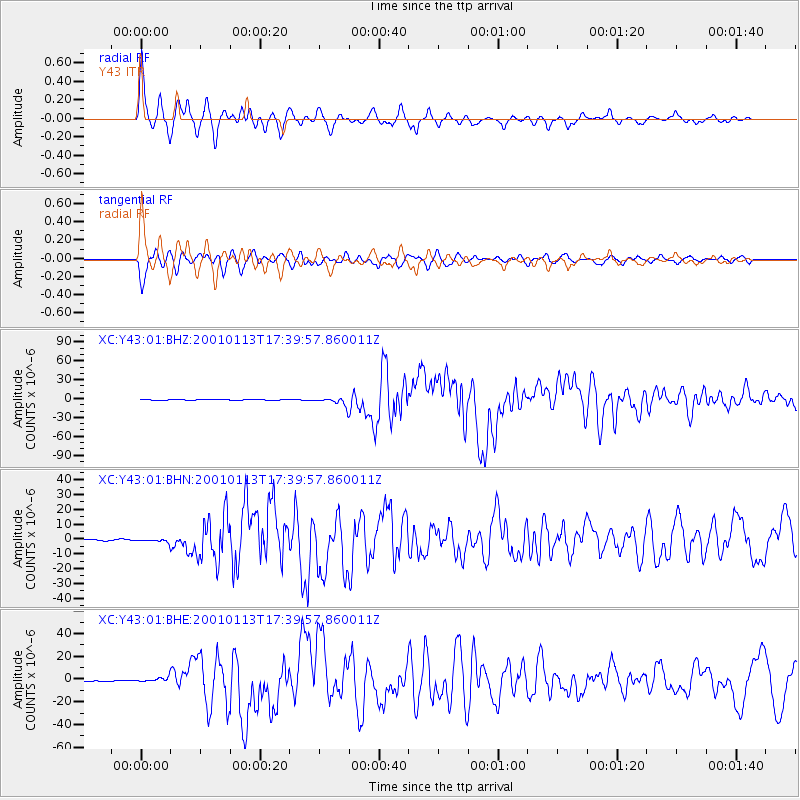
Earthquake location: El Salvador
Earthquake latitude/longitude: 13.0/-88.7
Earthquake time(UTC): 2001/01/13 (013) 17:33:32 GMT
Earthquake Depth: 60 km
Earthquake Magnitude: 6.4 MB, 7.8 MS, 7.7 MW, 7.5 ME
Earthquake Catalog/Contributor: WHDF/NEIC
Network: XC Yellowstone Intermountain Seismic Array
Station: Y43 Y43
Lat/Lon: 44.45 N/109.60 W
Elevation: 1897 m
Distance: 36.1 deg
Az: 334.228 deg
Baz: 143.727 deg
Ray Param: 0.07672187
Estimated Moho Depth: 37.75 km
Estimated Crust Vp/Vs: 2.01
Assumed Crust Vp: 6.242 km/s
Estimated Crust Vs: 3.113 km/s
Estimated Crust Poisson's Ratio: 0.33
Radial Match: 93.11994 %
Radial Bump: 361
Transverse Match: 90.043884 %
Transverse Bump: 400
SOD ConfigId: 16820
Insert Time: 2010-02-26 15:04:27.645 +0000
GWidth: 2.5
Max Bumps: 400
Tol: 0.001

Signal To Noise

ChannelStoNSTALTA
XC:Y43:01:BHN:20010113T17:39:57.860011Z4.08213761.3713175E-63.3593122E-7
XC:Y43:01:BHE:20010113T17:39:57.860011Z8.2036582.3662942E-62.884438E-7
XC:Y43:01:BHZ:20010113T17:39:57.860011Z9.1503776.1016776E-66.6682253E-7
Arrivals
Ps6.5 SECOND
PpPs17 SECOND
PsPs/PpSs24 SECOND