Y44 Y44 - Earthquake Result Viewer
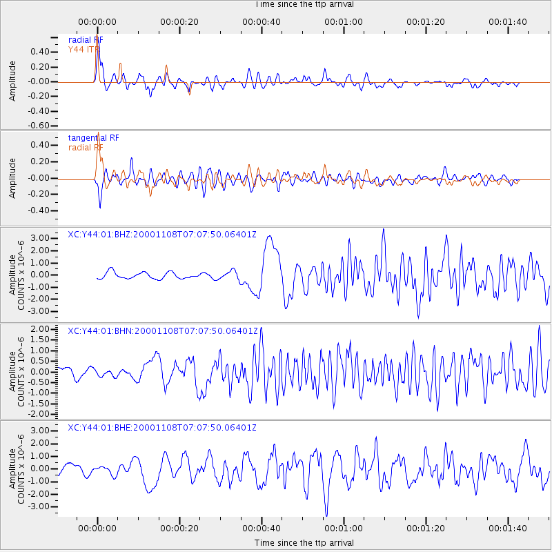
Earthquake location: Panama-Colombia Border Region
Earthquake latitude/longitude: 7.0/-77.8
Earthquake time(UTC): 2000/11/08 (313) 06:59:58 GMT
Earthquake Depth: 17 km
Earthquake Magnitude: 6.0 MB, 6.4 MS, 6.5 MW, 6.2 ML
Earthquake Catalog/Contributor: WHDF/NEIC
Network: XC Yellowstone Intermountain Seismic Array
Station: Y44 Y44
Lat/Lon: 44.10 N/109.19 W
Elevation: 2121 m
Distance: 46.0 deg
Az: 328.567 deg
Baz: 134.071 deg
Ray Param: 0.0709186
Estimated Moho Depth: 38.75 km
Estimated Crust Vp/Vs: 1.60
Assumed Crust Vp: 6.242 km/s
Estimated Crust Vs: 3.901 km/s
Estimated Crust Poisson's Ratio: 0.18
Radial Match: 86.61461 %
Radial Bump: 400
Transverse Match: 79.40517 %
Transverse Bump: 400
SOD ConfigId: 3744
Insert Time: 2010-02-26 15:04:32.221 +0000
GWidth: 2.5
Max Bumps: 400
Tol: 0.001

Signal To Noise

ChannelStoNSTALTA
XC:Y44:01:BHN:20001108T07:07:50.06401Z0.566967961.5355258E-72.7083112E-7
XC:Y44:01:BHE:20001108T07:07:50.06401Z0.9866143.5235422E-73.571348E-7
XC:Y44:01:BHZ:20001108T07:07:50.06401Z1.33153493.537234E-72.6565087E-7
Arrivals
Ps4.0 SECOND
PpPs15 SECOND
PsPs/PpSs19 SECOND