Y44 Y44 - Earthquake Result Viewer
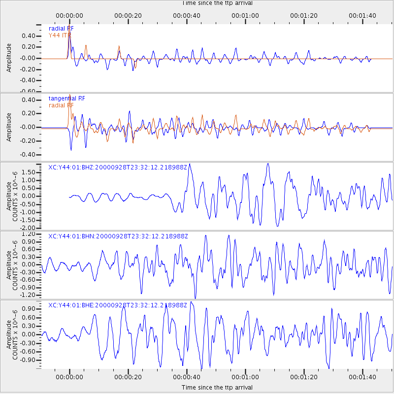
Earthquake location: Near Coast Of Ecuador
Earthquake latitude/longitude: -0.2/-80.6
Earthquake time(UTC): 2000/09/28 (272) 23:23:43 GMT
Earthquake Depth: 23 km
Earthquake Magnitude: 5.8 MB, 6.0 MS, 6.6 MW, 6.4 MW
Earthquake Catalog/Contributor: WHDF/NEIC
Network: XC Yellowstone Intermountain Seismic Array
Station: Y44 Y44
Lat/Lon: 44.10 N/109.19 W
Elevation: 2121 m
Distance: 51.0 deg
Az: 333.632 deg
Baz: 141.941 deg
Ray Param: 0.067682415
Estimated Moho Depth: 44.0 km
Estimated Crust Vp/Vs: 1.60
Assumed Crust Vp: 6.242 km/s
Estimated Crust Vs: 3.895 km/s
Estimated Crust Poisson's Ratio: 0.18
Radial Match: 80.11697 %
Radial Bump: 400
Transverse Match: 76.56012 %
Transverse Bump: 400
SOD ConfigId: 3744
Insert Time: 2010-02-26 15:04:33.227 +0000
GWidth: 2.5
Max Bumps: 400
Tol: 0.001

Signal To Noise

ChannelStoNSTALTA
XC:Y44:01:BHN:20000928T23:32:12.218988Z0.717245641.17461376E-71.637673E-7
XC:Y44:01:BHE:20000928T23:32:12.218988Z0.81182351.321171E-71.6274116E-7
XC:Y44:01:BHZ:20000928T23:32:12.218988Z0.64084031.02456454E-71.598783E-7
Arrivals
Ps4.5 SECOND
PpPs17 SECOND
PsPs/PpSs22 SECOND