Y44 Y44 - Earthquake Result Viewer
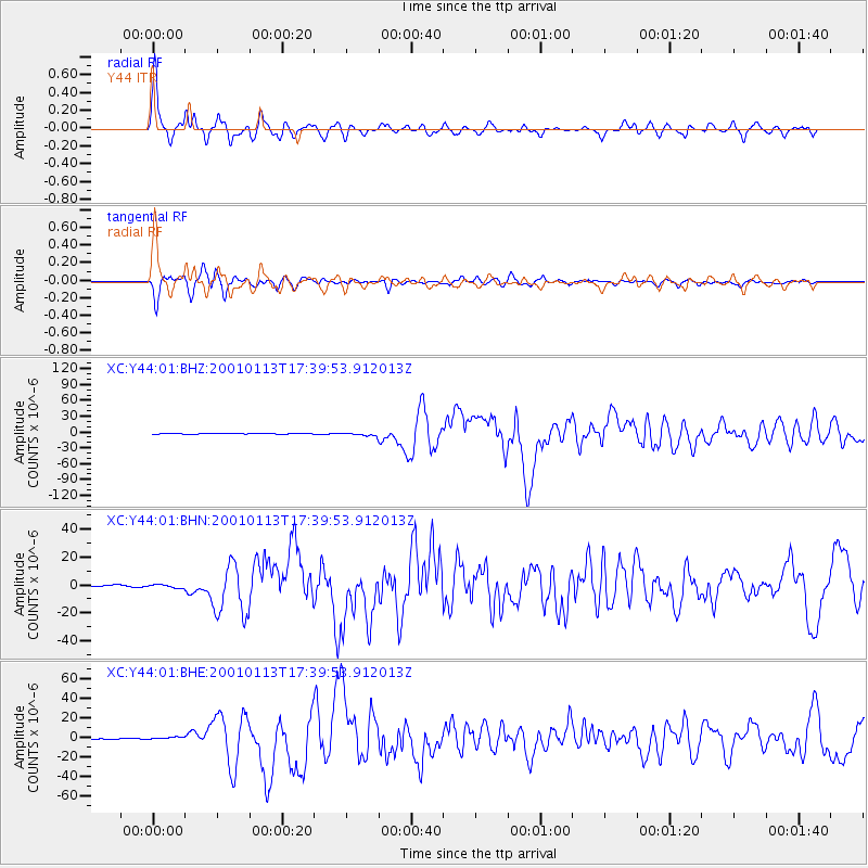
Earthquake location: El Salvador
Earthquake latitude/longitude: 13.0/-88.7
Earthquake time(UTC): 2001/01/13 (013) 17:33:32 GMT
Earthquake Depth: 60 km
Earthquake Magnitude: 6.4 MB, 7.8 MS, 7.7 MW, 7.5 ME
Earthquake Catalog/Contributor: WHDF/NEIC
Network: XC Yellowstone Intermountain Seismic Array
Station: Y44 Y44
Lat/Lon: 44.10 N/109.19 W
Elevation: 2121 m
Distance: 35.6 deg
Az: 334.279 deg
Baz: 144.053 deg
Ray Param: 0.07697008
Estimated Moho Depth: 41.25 km
Estimated Crust Vp/Vs: 1.73
Assumed Crust Vp: 6.242 km/s
Estimated Crust Vs: 3.603 km/s
Estimated Crust Poisson's Ratio: 0.25
Radial Match: 91.15563 %
Radial Bump: 400
Transverse Match: 87.13215 %
Transverse Bump: 400
SOD ConfigId: 16820
Insert Time: 2010-02-26 15:04:39.900 +0000
GWidth: 2.5
Max Bumps: 400
Tol: 0.001

Signal To Noise

ChannelStoNSTALTA
XC:Y44:01:BHN:20010113T17:39:53.912013Z3.03253821.1797322E-63.8902465E-7
XC:Y44:01:BHE:20010113T17:39:53.912013Z3.85903761.2049096E-63.1223058E-7
XC:Y44:01:BHZ:20010113T17:39:53.912013Z5.29145052.6533348E-65.014381E-7
Arrivals
Ps5.2 SECOND
PpPs17 SECOND
PsPs/PpSs22 SECOND