Y44 Y44 - Earthquake Result Viewer
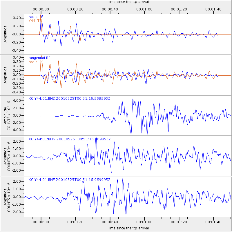
Earthquake location: Kuril Islands
Earthquake latitude/longitude: 44.3/148.4
Earthquake time(UTC): 2001/05/25 (145) 00:40:50 GMT
Earthquake Depth: 33 km
Earthquake Magnitude: 6.1 MB, 6.7 MS, 6.7 MW, 6.6 MW
Earthquake Catalog/Contributor: WHDF/NEIC
Network: XC Yellowstone Intermountain Seismic Array
Station: Y44 Y44
Lat/Lon: 44.10 N/109.19 W
Elevation: 2121 m
Distance: 68.2 deg
Az: 49.261 deg
Baz: 310.925 deg
Ray Param: 0.05639848
Estimated Moho Depth: 51.25 km
Estimated Crust Vp/Vs: 1.61
Assumed Crust Vp: 6.242 km/s
Estimated Crust Vs: 3.871 km/s
Estimated Crust Poisson's Ratio: 0.19
Radial Match: 87.02504 %
Radial Bump: 400
Transverse Match: 76.96577 %
Transverse Bump: 400
SOD ConfigId: 4714
Insert Time: 2010-02-26 15:04:41.046 +0000
GWidth: 2.5
Max Bumps: 400
Tol: 0.001

Signal To Noise

ChannelStoNSTALTA
XC:Y44:01:BHN:20010525T00:51:16.969995Z2.62683732.5834183E-79.83471E-8
XC:Y44:01:BHE:20010525T00:51:16.969995Z1.18955851.1751024E-79.878475E-8
XC:Y44:01:BHZ:20010525T00:51:16.969995Z2.2006811.4792556E-76.721809E-8
Arrivals
Ps5.2 SECOND
PpPs21 SECOND
PsPs/PpSs26 SECOND