INEE Inewari High School - Earthquake Result Viewer
Earthquake location: Andaman Islands, India Region
Earthquake latitude/longitude: 13.0/93.1
Earthquake time(UTC): 2002/09/13 (256) 22:28:29 GMT
Earthquake Depth: 21 km
Earthquake Magnitude: 6.2 MB, 6.7 MS, 6.5 MW, 6.5 MW
Earthquake Catalog/Contributor: WHDF/NEIC
Network: YJ Ethiopia-Afar Geoscientific Lithospheric Experiment
Station: INEE Inewari High School
Lat/Lon: 9.90 N/39.14 E
Elevation: 2686 m
Distance: 52.9 deg
Az: 272.613 deg
Baz: 81.135 deg
Ray Param: 0.06645648
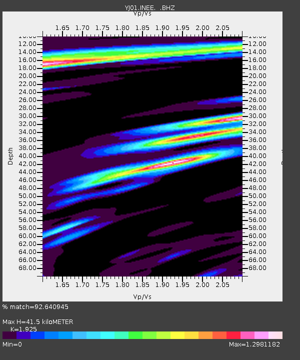
Estimated Moho Depth: 41.5 km
Estimated Crust Vp/Vs: 1.92
Assumed Crust Vp: 6.464 km/s
Estimated Crust Vs: 3.358 km/s
Estimated Crust Poisson's Ratio: 0.32
Radial Match: 92.640945 %
Radial Bump: 400
Transverse Match: 77.88595 %
Transverse Bump: 400
SOD ConfigId: 16820
Insert Time: 2010-03-09 00:43:01.602 +0000
GWidth: 2.5
Max Bumps: 400
Tol: 0.001

Signal To Noise

ChannelStoNSTALTA
YJ:INEE: :BHZ:20020913T22:37:12.678018Z1.06271238.411058E-87.9147085E-8
YJ:INEE: :BHN:20020913T22:37:12.678018Z0.70520056.52134E-89.247498E-8
YJ:INEE: :BHE:20020913T22:37:12.678018Z1.04981041.1429395E-71.08871035E-7
Arrivals
Ps6.2 SECOND
PpPs18 SECOND
PsPs/PpSs24 SECOND