Y20 Y20 - Earthquake Result Viewer
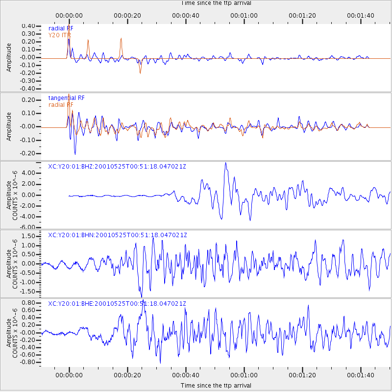
Earthquake location: Kuril Islands
Earthquake latitude/longitude: 44.3/148.4
Earthquake time(UTC): 2001/05/25 (145) 00:40:50 GMT
Earthquake Depth: 33 km
Earthquake Magnitude: 6.1 MB, 6.7 MS, 6.7 MW, 6.6 MW
Earthquake Catalog/Contributor: WHDF/NEIC
Network: XC Yellowstone Intermountain Seismic Array
Station: Y20 Y20
Lat/Lon: 43.17 N/110.00 W
Elevation: 2357 m
Distance: 68.4 deg
Az: 50.43 deg
Baz: 310.802 deg
Ray Param: 0.056291085
Estimated Moho Depth: 10.0 km
Estimated Crust Vp/Vs: 1.74
Assumed Crust Vp: 6.161 km/s
Estimated Crust Vs: 3.551 km/s
Estimated Crust Poisson's Ratio: 0.25
Radial Match: 86.25936 %
Radial Bump: 400
Transverse Match: 84.94413 %
Transverse Bump: 400
SOD ConfigId: 4714
Insert Time: 2010-02-26 15:04:51.658 +0000
GWidth: 2.5
Max Bumps: 400
Tol: 0.001

Signal To Noise

ChannelStoNSTALTA
XC:Y20:01:BHN:20010525T00:51:18.047021Z2.27226541.7313675E-77.619566E-8
XC:Y20:01:BHE:20010525T00:51:18.047021Z1.61486358.197052E-85.076003E-8
XC:Y20:01:BHZ:20010525T00:51:18.047021Z2.60680912.1934571E-78.414337E-8
Arrivals
Ps1.2 SECOND
PpPs4.3 SECOND
PsPs/PpSs5.5 SECOND