Y19 Y19 - Earthquake Result Viewer
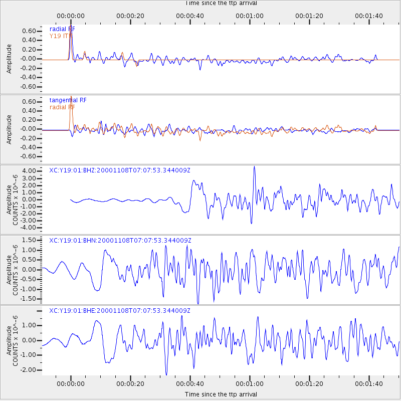
Earthquake location: Panama-Colombia Border Region
Earthquake latitude/longitude: 7.0/-77.8
Earthquake time(UTC): 2000/11/08 (313) 06:59:58 GMT
Earthquake Depth: 17 km
Earthquake Magnitude: 6.0 MB, 6.4 MS, 6.5 MW, 6.2 ML
Earthquake Catalog/Contributor: WHDF/NEIC
Network: XC Yellowstone Intermountain Seismic Array
Station: Y19 Y19
Lat/Lon: 43.62 N/110.60 W
Elevation: 2091 m
Distance: 46.4 deg
Az: 327.11 deg
Baz: 132.085 deg
Ray Param: 0.07065966
Estimated Moho Depth: 60.25 km
Estimated Crust Vp/Vs: 1.94
Assumed Crust Vp: 6.207 km/s
Estimated Crust Vs: 3.195 km/s
Estimated Crust Poisson's Ratio: 0.32
Radial Match: 80.11922 %
Radial Bump: 400
Transverse Match: 76.22517 %
Transverse Bump: 400
SOD ConfigId: 3744
Insert Time: 2010-02-26 15:05:24.690 +0000
GWidth: 2.5
Max Bumps: 400
Tol: 0.001

Signal To Noise

ChannelStoNSTALTA
XC:Y19:01:BHN:20001108T07:07:53.344009Z2.66033863.11299E-71.1701481E-7
XC:Y19:01:BHE:20001108T07:07:53.344009Z2.1801574.0350594E-71.8508115E-7
XC:Y19:01:BHZ:20001108T07:07:53.344009Z1.69527732.2539963E-71.3295738E-7
Arrivals
Ps9.6 SECOND
PpPs27 SECOND
PsPs/PpSs37 SECOND