Y19 Y19 - Earthquake Result Viewer
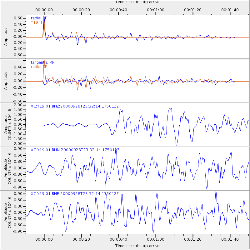
Earthquake location: Near Coast Of Ecuador
Earthquake latitude/longitude: -0.2/-80.6
Earthquake time(UTC): 2000/09/28 (272) 23:23:43 GMT
Earthquake Depth: 23 km
Earthquake Magnitude: 5.8 MB, 6.0 MS, 6.6 MW, 6.4 MW
Earthquake Catalog/Contributor: WHDF/NEIC
Network: XC Yellowstone Intermountain Seismic Array
Station: Y19 Y19
Lat/Lon: 43.62 N/110.60 W
Elevation: 2091 m
Distance: 51.2 deg
Az: 332.22 deg
Baz: 140.077 deg
Ray Param: 0.06751484
Estimated Moho Depth: 31.75 km
Estimated Crust Vp/Vs: 1.82
Assumed Crust Vp: 6.207 km/s
Estimated Crust Vs: 3.415 km/s
Estimated Crust Poisson's Ratio: 0.28
Radial Match: 87.72957 %
Radial Bump: 400
Transverse Match: 79.42416 %
Transverse Bump: 400
SOD ConfigId: 3744
Insert Time: 2010-02-26 15:05:25.934 +0000
GWidth: 2.5
Max Bumps: 400
Tol: 0.001

Signal To Noise

ChannelStoNSTALTA
XC:Y19:01:BHN:20000928T23:32:14.175012Z0.965511261.6704529E-71.7301227E-7
XC:Y19:01:BHE:20000928T23:32:14.175012Z1.76554112.1566757E-71.221538E-7
XC:Y19:01:BHZ:20000928T23:32:14.175012Z1.37036421.3992927E-71.0211101E-7
Arrivals
Ps4.4 SECOND
PpPs14 SECOND
PsPs/PpSs18 SECOND