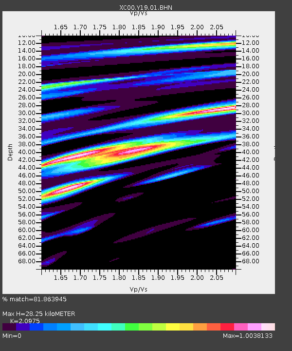
Y19 Y19 - Earthquake Result Viewer
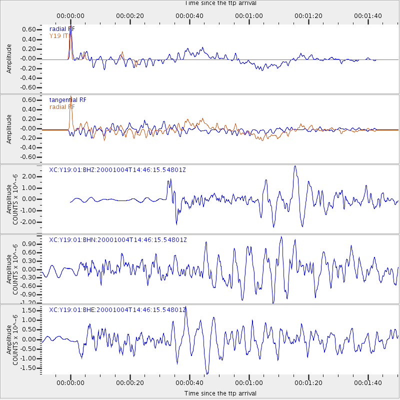
Earthquake location: Windward Islands
Earthquake latitude/longitude: 11.1/-62.6
Earthquake time(UTC): 2000/10/04 (278) 14:37:44 GMT
Earthquake Depth: 110 km
Earthquake Magnitude: 5.6 MB, 5.4 MS, 6.1 MW, 5.9 MD
Earthquake Catalog/Contributor: WHDF/NEIC
Network: XC Yellowstone Intermountain Seismic Array
Station: Y19 Y19
Lat/Lon: 43.62 N/110.60 W
Elevation: 2091 m
Distance: 52.5 deg
Az: 317.12 deg
Baz: 113.135 deg
Ray Param: 0.06634339
Estimated Moho Depth: 28.25 km
Estimated Crust Vp/Vs: 2.10
Assumed Crust Vp: 6.207 km/s
Estimated Crust Vs: 2.959 km/s
Estimated Crust Poisson's Ratio: 0.35
Radial Match: 81.863945 %
Radial Bump: 400
Transverse Match: 84.13199 %
Transverse Bump: 400
SOD ConfigId: 16820
Insert Time: 2010-02-26 15:05:29.847 +0000
GWidth: 2.5
Max Bumps: 400
Tol: 0.001

Signal To Noise

ChannelStoNSTALTA
XC:Y19:01:BHN:20001004T14:46:15.54801Z1.36999652.0985122E-71.5317646E-7
XC:Y19:01:BHE:20001004T14:46:15.54801Z3.00841764.69469E-71.560518E-7
XC:Y19:01:BHZ:20001004T14:46:15.54801Z7.1339737.7081177E-71.08048035E-7
Arrivals
Ps5.2 SECOND
PpPs14 SECOND
PsPs/PpSs19 SECOND