Y19 Y19 - Earthquake Result Viewer
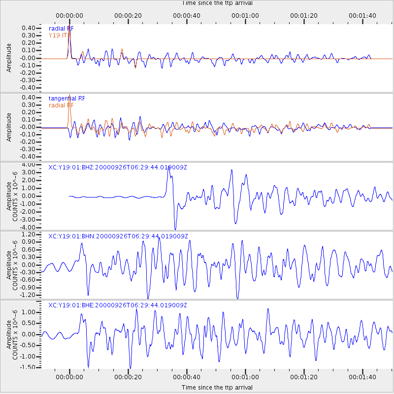
Earthquake location: Tonga Islands
Earthquake latitude/longitude: -17.2/-173.9
Earthquake time(UTC): 2000/09/26 (270) 06:17:52 GMT
Earthquake Depth: 56 km
Earthquake Magnitude: 6.1 MB, 6.1 MS, 6.4 MW, 6.1 ME
Earthquake Catalog/Contributor: WHDF/NEIC
Network: XC Yellowstone Intermountain Seismic Array
Station: Y19 Y19
Lat/Lon: 43.62 N/110.60 W
Elevation: 2091 m
Distance: 83.7 deg
Az: 40.761 deg
Baz: 239.249 deg
Ray Param: 0.045906283
Estimated Moho Depth: 27.5 km
Estimated Crust Vp/Vs: 1.92
Assumed Crust Vp: 6.207 km/s
Estimated Crust Vs: 3.237 km/s
Estimated Crust Poisson's Ratio: 0.31
Radial Match: 92.126785 %
Radial Bump: 400
Transverse Match: 88.77225 %
Transverse Bump: 400
SOD ConfigId: 16820
Insert Time: 2010-02-26 15:05:30.879 +0000
GWidth: 2.5
Max Bumps: 400
Tol: 0.001

Signal To Noise

ChannelStoNSTALTA
XC:Y19:01:BHN:20000926T06:29:44.019009Z3.29726243.7802513E-71.14648174E-7
XC:Y19:01:BHE:20000926T06:29:44.019009Z3.59151893.9346597E-71.095542E-7
XC:Y19:01:BHZ:20000926T06:29:44.019009Z23.6697181.628364E-66.8795245E-8
Arrivals
Ps4.2 SECOND
PpPs13 SECOND
PsPs/PpSs17 SECOND