Y19 Y19 - Earthquake Result Viewer
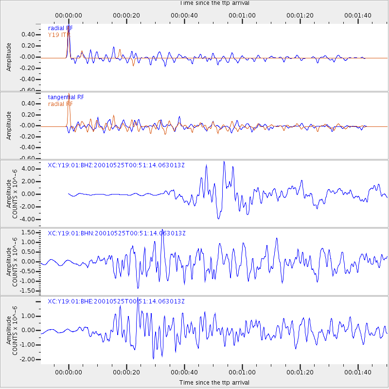
Earthquake location: Kuril Islands
Earthquake latitude/longitude: 44.3/148.4
Earthquake time(UTC): 2001/05/25 (145) 00:40:50 GMT
Earthquake Depth: 33 km
Earthquake Magnitude: 6.1 MB, 6.7 MS, 6.7 MW, 6.6 MW
Earthquake Catalog/Contributor: WHDF/NEIC
Network: XC Yellowstone Intermountain Seismic Array
Station: Y19 Y19
Lat/Lon: 43.62 N/110.60 W
Elevation: 2091 m
Distance: 67.8 deg
Az: 50.375 deg
Baz: 310.365 deg
Ray Param: 0.056699865
Estimated Moho Depth: 36.5 km
Estimated Crust Vp/Vs: 1.77
Assumed Crust Vp: 6.207 km/s
Estimated Crust Vs: 3.507 km/s
Estimated Crust Poisson's Ratio: 0.27
Radial Match: 95.993515 %
Radial Bump: 400
Transverse Match: 87.57451 %
Transverse Bump: 400
SOD ConfigId: 4714
Insert Time: 2010-02-26 15:05:38.041 +0000
GWidth: 2.5
Max Bumps: 400
Tol: 0.001

Signal To Noise

ChannelStoNSTALTA
XC:Y19:01:BHN:20010525T00:51:14.063013Z1.61132981.1074448E-76.8728625E-8
XC:Y19:01:BHE:20010525T00:51:14.063013Z1.17554011.07504434E-79.1451106E-8
XC:Y19:01:BHZ:20010525T00:51:14.063013Z2.28936742.2157286E-79.678345E-8
Arrivals
Ps4.7 SECOND
PpPs16 SECOND
PsPs/PpSs20 SECOND