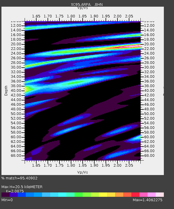
ARPA Arthurs Pass - Earthquake Result Viewer
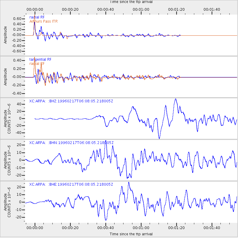
Earthquake location: Irian Jaya Region, Indonesia
Earthquake latitude/longitude: -0.9/137.0
Earthquake time(UTC): 1996/02/17 (048) 05:59:29 GMT
Earthquake Depth: 33 km
Earthquake Magnitude: 6.5 MB, 8.1 MS, 7.9 UNKNOWN
Earthquake Catalog/Contributor: WHDF/NEIC
Network: XC Southern Alps Passive Seismic Experiment
Station: ARPA Arthurs Pass
Lat/Lon: 42.97 S/171.58 E
Elevation: 710 m
Distance: 52.0 deg
Az: 148.117 deg
Baz: 313.981 deg
Ray Param: 0.06697572
Estimated Moho Depth: 20.5 km
Estimated Crust Vp/Vs: 2.09
Assumed Crust Vp: 6.461 km/s
Estimated Crust Vs: 3.095 km/s
Estimated Crust Poisson's Ratio: 0.35
Radial Match: 95.40902 %
Radial Bump: 400
Transverse Match: 81.82321 %
Transverse Bump: 400
SOD ConfigId: 6273
Insert Time: 2010-02-26 15:05:45.593 +0000
GWidth: 2.5
Max Bumps: 400
Tol: 0.001

Signal To Noise

ChannelStoNSTALTA
XC:ARPA: :BHN:19960217T06:08:05.218005Z1.87256552.1446688E-61.1453103E-6
XC:ARPA: :BHE:19960217T06:08:05.218005Z0.53619339.799504E-71.8276065E-6
XC:ARPA: :BHZ:19960217T06:08:05.218005Z3.18861992.7745155E-68.701306E-7
Arrivals
Ps3.6 SECOND
PpPs9.3 SECOND
PsPs/PpSs13 SECOND