BERA Berwen - Earthquake Result Viewer
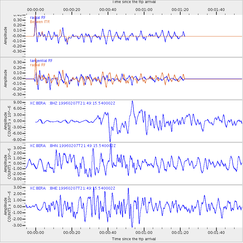
Earthquake location: Kuril Islands
Earthquake latitude/longitude: 45.3/149.9
Earthquake time(UTC): 1996/02/07 (038) 21:36:45 GMT
Earthquake Depth: 33 km
Earthquake Magnitude: 6.3 MB, 7.0 MS, 7.2 UNKNOWN, 7.1 MW
Earthquake Catalog/Contributor: WHDF/NEIC
Network: XC Southern Alps Passive Seismic Experiment
Station: BERA Berwen
Lat/Lon: 44.53 S/169.88 E
Elevation: 505 m
Distance: 91.2 deg
Az: 165.854 deg
Baz: 346.051 deg
Ray Param: 0.041614704
Estimated Moho Depth: 38.5 km
Estimated Crust Vp/Vs: 1.62
Assumed Crust Vp: 6.461 km/s
Estimated Crust Vs: 3.989 km/s
Estimated Crust Poisson's Ratio: 0.19
Radial Match: 83.54228 %
Radial Bump: 400
Transverse Match: 72.90652 %
Transverse Bump: 400
SOD ConfigId: 6273
Insert Time: 2010-02-26 15:05:58.463 +0000
GWidth: 2.5
Max Bumps: 400
Tol: 0.001

Signal To Noise

ChannelStoNSTALTA
XC:BERA: :BHN:19960207T21:49:15.540002Z1.49792797.2211094E-74.8207323E-7
XC:BERA: :BHE:19960207T21:49:15.540002Z1.04724223.8418892E-73.668578E-7
XC:BERA: :BHZ:19960207T21:49:15.540002Z2.75454451.1328879E-64.1127956E-7
Arrivals
Ps3.8 SECOND
PpPs15 SECOND
PsPs/PpSs19 SECOND