CLIA Clinton - Earthquake Result Viewer
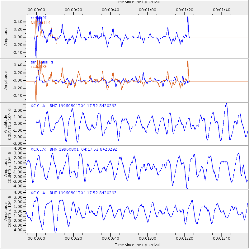
Earthquake location: Minahassa Peninsula, Sulawesi
Earthquake latitude/longitude: -0.0/122.9
Earthquake time(UTC): 1996/08/01 (214) 04:08:23 GMT
Earthquake Depth: 149 km
Earthquake Magnitude: 5.5 MB, 5.6 UNKNOWN, 5.5 MW
Earthquake Catalog/Contributor: WHDF/NEIC
Network: XC Southern Alps Passive Seismic Experiment
Station: CLIA Clinton
Lat/Lon: 46.29 S/169.31 E
Elevation: 352 m
Distance: 61.4 deg
Az: 145.133 deg
Baz: 304.469 deg
Ray Param: 0.0604586
Estimated Moho Depth: 17.75 km
Estimated Crust Vp/Vs: 1.92
Assumed Crust Vp: 6.183 km/s
Estimated Crust Vs: 3.216 km/s
Estimated Crust Poisson's Ratio: 0.31
Radial Match: 87.416084 %
Radial Bump: 400
Transverse Match: 53.632385 %
Transverse Bump: 359
SOD ConfigId: 4480
Insert Time: 2010-02-26 15:06:31.963 +0000
GWidth: 2.5
Max Bumps: 400
Tol: 0.001

Signal To Noise

ChannelStoNSTALTA
XC:CLIA: :BHN:19960801T04:17:52.842029Z1.4293681.4282183E-69.991957E-7
XC:CLIA: :BHE:19960801T04:17:52.842029Z2.24764632.3346322E-61.0387009E-6
XC:CLIA: :BHZ:19960801T04:17:52.842029Z0.78810399.560191E-71.2130623E-6
Arrivals
Ps2.8 SECOND
PpPs8.1 SECOND
PsPs/PpSs11 SECOND