EWZA Erewhon - Earthquake Result Viewer
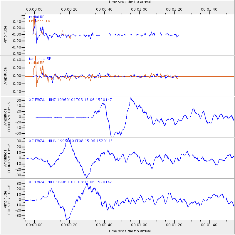
Earthquake location: Minahassa Peninsula, Sulawesi
Earthquake latitude/longitude: 0.7/120.0
Earthquake time(UTC): 1996/01/01 (001) 08:05:11 GMT
Earthquake Depth: 33 km
Earthquake Magnitude: 6.2 MB, 7.7 MS, 7.8 UNKNOWN, 7.8 MW
Earthquake Catalog/Contributor: WHDF/NEIC
Network: XC Southern Alps Passive Seismic Experiment
Station: EWZA Erewhon
Lat/Lon: 43.51 S/170.85 E
Elevation: 625 m
Distance: 63.2 deg
Az: 140.789 deg
Baz: 299.678 deg
Ray Param: 0.059661143
Estimated Moho Depth: 27.0 km
Estimated Crust Vp/Vs: 1.85
Assumed Crust Vp: 6.461 km/s
Estimated Crust Vs: 3.502 km/s
Estimated Crust Poisson's Ratio: 0.29
Radial Match: 97.28851 %
Radial Bump: 351
Transverse Match: 95.07967 %
Transverse Bump: 400
SOD ConfigId: 6273
Insert Time: 2010-02-26 15:06:50.156 +0000
GWidth: 2.5
Max Bumps: 400
Tol: 0.001

Signal To Noise

ChannelStoNSTALTA
XC:EWZA: :BHN:19960101T08:15:06.152014Z2.0216691.3790179E-66.821185E-7
XC:EWZA: :BHE:19960101T08:15:06.152014Z3.18686991.9339038E-66.0683493E-7
XC:EWZA: :BHZ:19960101T08:15:06.152014Z9.7522197.2292482E-67.4129264E-7
Arrivals
Ps3.7 SECOND
PpPs11 SECOND
PsPs/PpSs15 SECOND