HOKA Hokitika - Earthquake Result Viewer
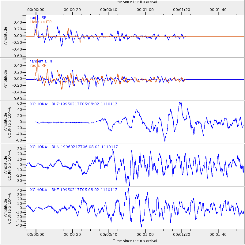
Earthquake location: Irian Jaya Region, Indonesia
Earthquake latitude/longitude: -0.9/137.0
Earthquake time(UTC): 1996/02/17 (048) 05:59:29 GMT
Earthquake Depth: 33 km
Earthquake Magnitude: 6.5 MB, 8.1 MS, 7.9 UNKNOWN
Earthquake Catalog/Contributor: WHDF/NEIC
Network: XC Southern Alps Passive Seismic Experiment
Station: HOKA Hokitika
Lat/Lon: 42.74 S/171.09 E
Elevation: 240 m
Distance: 51.6 deg
Az: 148.222 deg
Baz: 314.376 deg
Ray Param: 0.06725451
Estimated Moho Depth: 10.5 km
Estimated Crust Vp/Vs: 1.62
Assumed Crust Vp: 6.461 km/s
Estimated Crust Vs: 3.982 km/s
Estimated Crust Poisson's Ratio: 0.19
Radial Match: 89.9537 %
Radial Bump: 400
Transverse Match: 75.18756 %
Transverse Bump: 400
SOD ConfigId: 6273
Insert Time: 2010-02-26 15:07:07.517 +0000
GWidth: 2.5
Max Bumps: 400
Tol: 0.001

Signal To Noise

ChannelStoNSTALTA
XC:HOKA: :BHN:19960217T06:08:02.111011Z1.69203032.4781907E-61.4646254E-6
XC:HOKA: :BHE:19960217T06:08:02.111011Z0.68657122.541529E-63.7017708E-6
XC:HOKA: :BHZ:19960217T06:08:02.111011Z3.36782772.8342265E-68.4155926E-7
Arrivals
Ps1.1 SECOND
PpPs4.0 SECOND
PsPs/PpSs5.1 SECOND