
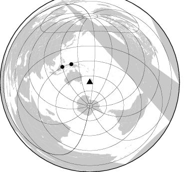
Station XC HOKA - Hokitika
Network: XC95 - Southern Alps Passive Seismic Experiment
Nearby stations (2 deg radius)

| Station | Name | (Lat, Lon) | Start / End | Elevation |
| HOKA | Hokitika | (-42.74, 171.09) | 1995-11-13 / 1996-12-31 | 240 m |
| Crust2 Type: | K2,forearc, New Zealand, 0.7 km seds. |
| Thickness Estimate: | 41 km |
| Thickness StdDev: | 3.1 km |
| Vp/Vs Estimate: | 1.99 |
| Vp/Vs StdDev: | 0.16 |
| Vs Estimate: | 3.247 km/s |
| Poisson's Ratio: | 0.33 |
| Peak Value: | 0.08 |
| Assumed Vp: | 6.461 km/s |
| Ps Weight: | 0.33333334 |
| PpPs Weight: | 0.33333334 |
| PsPs Weight: | 0.33333328 |
| Residual Complexity: | 0.748 |
| Nearby stations H: | +- |
| (2.0 deg) Vp/Vs: | +- |
1 with match > 90% ( 16.666666 %) and 2 with match > 80% ( 33.333332 %) out of 6.
Download stack as xyz text file.
Azimuth Distribution of Events:
Prior Results for this Station
| Study | Thickness | Vp/Vs | Vp | Vs | Poissons Ratio | Extra |
| EARS | 41 km | 1.99 | 6.461 km/s | 3.247 km/s | 0.33 | |
| Crust2.0 | 35 km | 1.76 | 6.461 km/s | 3.663 km/s | 0.26 | K2,forearc, New Zealand, 0.7 km seds. |
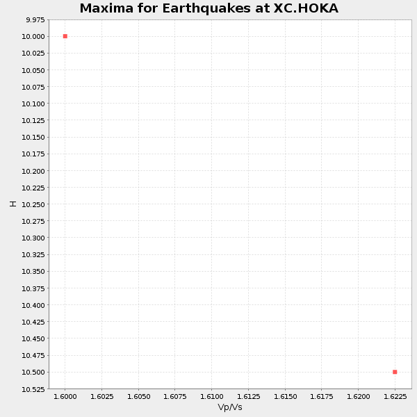
| Global Maxima | 41 km | 1.99 | 6.461 km/s | 3.247 km/s | 0.33 | amp=0.07636227 |
| Local Maxima 1 | 32 km | 1.70 | 6.461 km/s | 3.795 km/s | 0.24 | amp=0.064033456 |
| Local Maxima 2 | 40 km | 1.97 | 6.461 km/s | 3.284 km/s | 0.33 | amp=0.04720243 |
| Local Maxima 3 | 58 km | 1.69 | 6.461 km/s | 3.835 km/s | 0.23 | amp=0.03948362 |
| Local Maxima 4 | 32 km | 1.60 | 6.461 km/s | 4.038 km/s | 0.18 | amp=0.03332992 |
| Predicted Arrivals for vertical incidence (zero ray parameter) | |
| Ps | 6.24 SECOND |
| PpPs | 18.86 SECOND |
| PsPs/PpSs | 25.10 SECOND |
Events Processed for this Station
Download zip of receiver functions as SAC
Plot maxima for each earthquake.
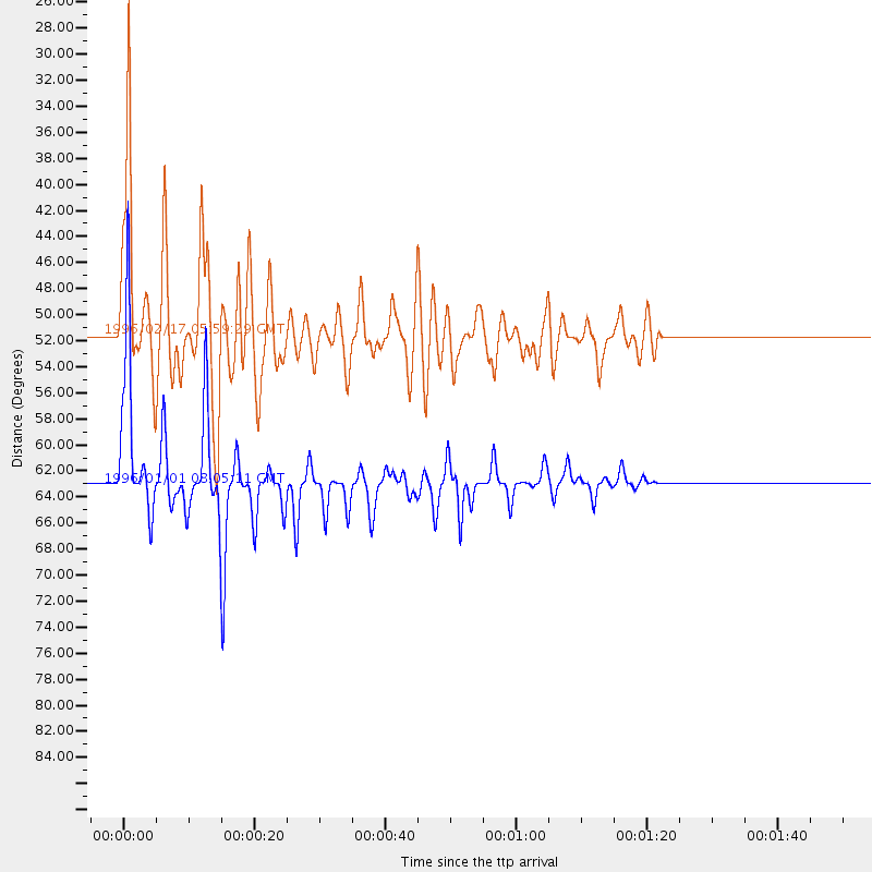
Events Used in the Stack
(2 events)| Radial Match | Distance | Baz | FERegion | Time | Lat/Lon | Depth | Magnitude |
| 95.22321 | 63.0 deg | 299.132 deg | Minahassa Peninsula, Sulawesi | 1996/01/01 08:05:11 GMT | (0.7, 120.0) | 33 km | 6.2 MB, 7.7 MS, 7.8 UNKNOWN, 7.8 MW |
| 89.9537 | 51.6 deg | 314.376 deg | Irian Jaya Region, Indonesia | 1996/02/17 05:59:29 GMT | (-0.9, 137.0) | 33 km | 6.5 MB, 8.1 MS, 7.9 UNKNOWN |
Losers
(4 events)| Radial Match | Distance | Baz | FERegion | Time | Lat/Lon | Depth | Magnitude | Reason |
| 68.996826 | 60.0 deg | 305.287 deg | Northern Molucca Sea | 1996/02/28 09:44:09 GMT | (1.7, 126.1) | 103 km | 6.1 MB, 6.4 UNKNOWN, 6.4 MW | |
| 57.113758 | 55.2 deg | 288.678 deg | South Of Sumbawa, Indonesia | 1996/02/12 09:08:10 GMT | (-11.2, 118.7) | 33 km | 5.8 MB, 5.8 MS, 6.1 UNKNOWN, 6.0 MW | |
| 53.451252 | 81.2 deg | 282.41 deg | Off W Coast Of Northern Sumatra | 1995/11/22 13:27:53 GMT | (3.1, 95.9) | 28 km | 5.5 MB, 5.7 MS, 5.8 UNKNOWN, 5.8 MW | |
| 41.900063 | 90.0 deg | 342.646 deg | Kuril Islands | 1996/02/01 07:18:05 GMT | (44.9, 146.3) | 180 km | 5.7 MB, 6.2 UNKNOWN, 6.2 MW |
