You are here: Home > Network List > XC95 - Southern Alps Passive Seismic Experiment Stations List
> Station HOKA Hokitika > Earthquake Result Viewer
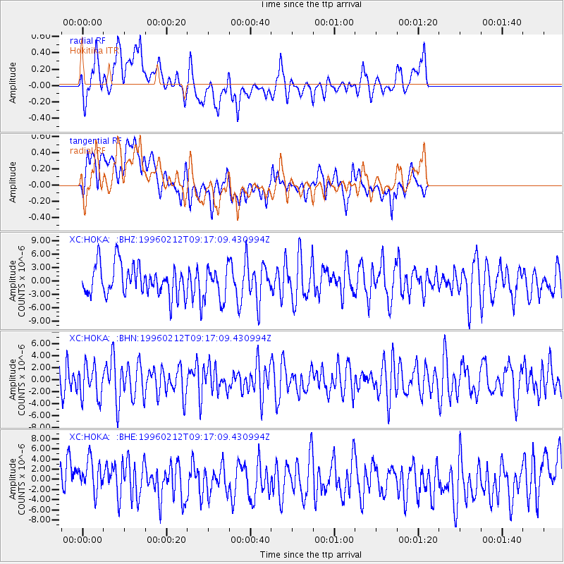
HOKA Hokitika - Earthquake Result Viewer
*The percent match for this event was below the threshold and hence no stack was calculated.
| Earthquake location: |
South Of Sumbawa, Indonesia |
| Earthquake latitude/longitude: |
-11.2/118.7 |
| Earthquake time(UTC): |
1996/02/12 (043) 09:08:10 GMT |
| Earthquake Depth: |
33 km |
| Earthquake Magnitude: |
5.8 MB, 5.8 MS, 6.1 UNKNOWN, 6.0 MW |
| Earthquake Catalog/Contributor: |
WHDF/NEIC |
|
| Network: |
XC Southern Alps Passive Seismic Experiment |
| Station: |
HOKA Hokitika |
| Lat/Lon: |
42.74 S/171.09 E |
| Elevation: |
240 m |
|
| Distance: |
55.2 deg |
| Az: |
134.67 deg |
| Baz: |
288.678 deg |
| Ray Param: |
$rayparam |
*The percent match for this event was below the threshold and hence was not used in the summary stack. |
|
| Radial Match: |
57.113758 % |
| Radial Bump: |
400 |
| Transverse Match: |
42.859646 % |
| Transverse Bump: |
400 |
| SOD ConfigId: |
4480 |
| Insert Time: |
2010-02-26 15:07:12.532 +0000 |
| GWidth: |
2.5 |
| Max Bumps: |
400 |
| Tol: |
0.001 |
|
Signal To Noise
| Channel | StoN | STA | LTA |
| XC:HOKA: :BHN:19960212T09:17:09.430994Z | 1.1289408 | 2.746664E-6 | 2.4329565E-6 |
| XC:HOKA: :BHE:19960212T09:17:09.430994Z | 0.7975992 | 3.9887486E-6 | 5.0009435E-6 |
| XC:HOKA: :BHZ:19960212T09:17:09.430994Z | 1.0597657 | 3.6240606E-6 | 3.4196808E-6 |
| Arrivals |
| Ps | |
| PpPs | |
| PsPs/PpSs | |


