You are here: Home > Network List > XC95 - Southern Alps Passive Seismic Experiment Stations List
> Station LATA Lake Taylor > Earthquake Result Viewer
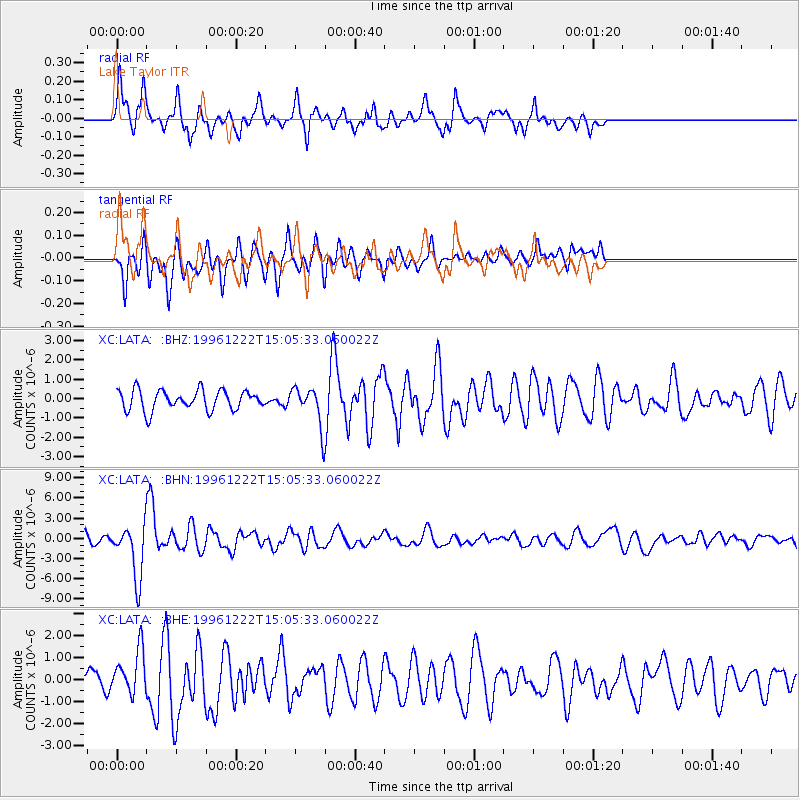
LATA Lake Taylor - Earthquake Result Viewer
*The percent match for this event was below the threshold and hence no stack was calculated.
| Earthquake location: |
Eastern Sea Of Japan |
| Earthquake latitude/longitude: |
43.2/138.9 |
| Earthquake time(UTC): |
1996/12/22 (357) 14:53:27 GMT |
| Earthquake Depth: |
227 km |
| Earthquake Magnitude: |
6.0 MB, 6.5 UNKNOWN, 6.5 MW |
| Earthquake Catalog/Contributor: |
WHDF/NEIC |
|
| Network: |
XC Southern Alps Passive Seismic Experiment |
| Station: |
LATA Lake Taylor |
| Lat/Lon: |
42.78 S/172.27 E |
| Elevation: |
640 m |
|
| Distance: |
90.7 deg |
| Az: |
156.124 deg |
| Baz: |
336.298 deg |
| Ray Param: |
$rayparam |
*The percent match for this event was below the threshold and hence was not used in the summary stack. |
|
| Radial Match: |
76.60609 % |
| Radial Bump: |
400 |
| Transverse Match: |
47.66569 % |
| Transverse Bump: |
400 |
| SOD ConfigId: |
4480 |
| Insert Time: |
2010-02-26 15:07:28.182 +0000 |
| GWidth: |
2.5 |
| Max Bumps: |
400 |
| Tol: |
0.001 |
|
Signal To Noise
| Channel | StoN | STA | LTA |
| XC:LATA: :BHN:19961222T15:05:33.060022Z | 3.1747804 | 3.999207E-6 | 1.2596798E-6 |
| XC:LATA: :BHE:19961222T15:05:33.060022Z | 1.5371314 | 1.0090105E-6 | 6.5642433E-7 |
| XC:LATA: :BHZ:19961222T15:05:33.060022Z | 1.8557881 | 9.604919E-7 | 5.175655E-7 |
| Arrivals |
| Ps | |
| PpPs | |
| PsPs/PpSs | |


