You are here: Home > Network List > XC95 - Southern Alps Passive Seismic Experiment Stations List
> Station LATA Lake Taylor > Earthquake Result Viewer
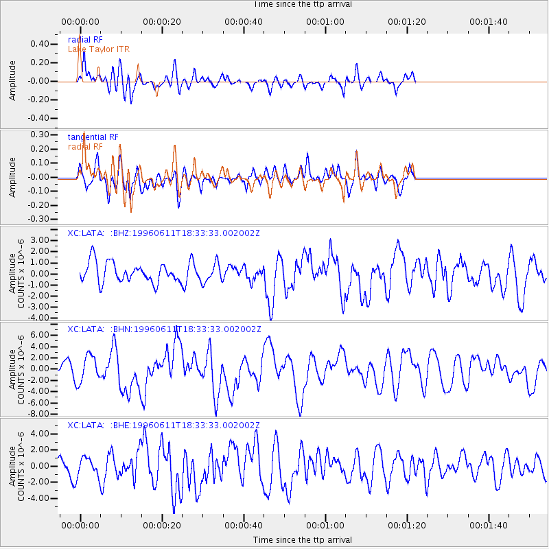
LATA Lake Taylor - Earthquake Result Viewer
*The percent match for this event was below the threshold and hence no stack was calculated.
| Earthquake location: |
Samar, Philippines |
| Earthquake latitude/longitude: |
12.6/125.2 |
| Earthquake time(UTC): |
1996/06/11 (163) 18:22:55 GMT |
| Earthquake Depth: |
33 km |
| Earthquake Magnitude: |
6.0 MB, 7.0 MS, 7.2 UNKNOWN, 7.1 MW |
| Earthquake Catalog/Contributor: |
WHDF/NEIC |
|
| Network: |
XC Southern Alps Passive Seismic Experiment |
| Station: |
LATA Lake Taylor |
| Lat/Lon: |
42.78 S/172.27 E |
| Elevation: |
640 m |
|
| Distance: |
70.0 deg |
| Az: |
144.962 deg |
| Baz: |
310.427 deg |
| Ray Param: |
$rayparam |
*The percent match for this event was below the threshold and hence was not used in the summary stack. |
|
| Radial Match: |
72.20434 % |
| Radial Bump: |
400 |
| Transverse Match: |
60.90227 % |
| Transverse Bump: |
400 |
| SOD ConfigId: |
4480 |
| Insert Time: |
2010-02-26 15:07:31.666 +0000 |
| GWidth: |
2.5 |
| Max Bumps: |
400 |
| Tol: |
0.001 |
|
Signal To Noise
| Channel | StoN | STA | LTA |
| XC:LATA: :BHN:19960611T18:33:33.002002Z | 1.6508706 | 2.4163555E-6 | 1.4636857E-6 |
| XC:LATA: :BHE:19960611T18:33:33.002002Z | 0.8421931 | 1.1135946E-6 | 1.3222557E-6 |
| XC:LATA: :BHZ:19960611T18:33:33.002002Z | 0.9418467 | 8.3666794E-7 | 8.8832707E-7 |
| Arrivals |
| Ps | |
| PpPs | |
| PsPs/PpSs | |


