You are here: Home > Network List > XC95 - Southern Alps Passive Seismic Experiment Stations List
> Station LATA Lake Taylor > Earthquake Result Viewer
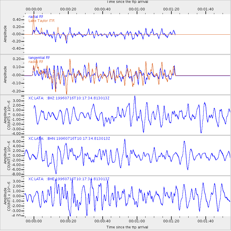
LATA Lake Taylor - Earthquake Result Viewer
*The percent match for this event was below the threshold and hence no stack was calculated.
| Earthquake location: |
Minahassa Peninsula, Sulawesi |
| Earthquake latitude/longitude: |
1.0/120.3 |
| Earthquake time(UTC): |
1996/07/16 (198) 10:07:36 GMT |
| Earthquake Depth: |
33 km |
| Earthquake Magnitude: |
6.0 MB, 6.4 MS, 6.6 UNKNOWN, 6.6 MW |
| Earthquake Catalog/Contributor: |
WHDF/NEIC |
|
| Network: |
XC Southern Alps Passive Seismic Experiment |
| Station: |
LATA Lake Taylor |
| Lat/Lon: |
42.78 S/172.27 E |
| Elevation: |
640 m |
|
| Distance: |
63.8 deg |
| Az: |
139.716 deg |
| Baz: |
298.586 deg |
| Ray Param: |
$rayparam |
*The percent match for this event was below the threshold and hence was not used in the summary stack. |
|
| Radial Match: |
76.11336 % |
| Radial Bump: |
400 |
| Transverse Match: |
39.257603 % |
| Transverse Bump: |
400 |
| SOD ConfigId: |
4480 |
| Insert Time: |
2010-02-26 15:07:32.889 +0000 |
| GWidth: |
2.5 |
| Max Bumps: |
400 |
| Tol: |
0.001 |
|
Signal To Noise
| Channel | StoN | STA | LTA |
| XC:LATA: :BHN:19960716T10:17:34.813013Z | 2.7167883 | 3.4903085E-6 | 1.2847186E-6 |
| XC:LATA: :BHE:19960716T10:17:34.813013Z | 1.1435673 | 1.0903372E-6 | 9.534525E-7 |
| XC:LATA: :BHZ:19960716T10:17:34.813013Z | 0.9323123 | 9.196181E-7 | 9.863842E-7 |
| Arrivals |
| Ps | |
| PpPs | |
| PsPs/PpSs | |


