You are here: Home > Network List > XC95 - Southern Alps Passive Seismic Experiment Stations List
> Station LATA Lake Taylor > Earthquake Result Viewer
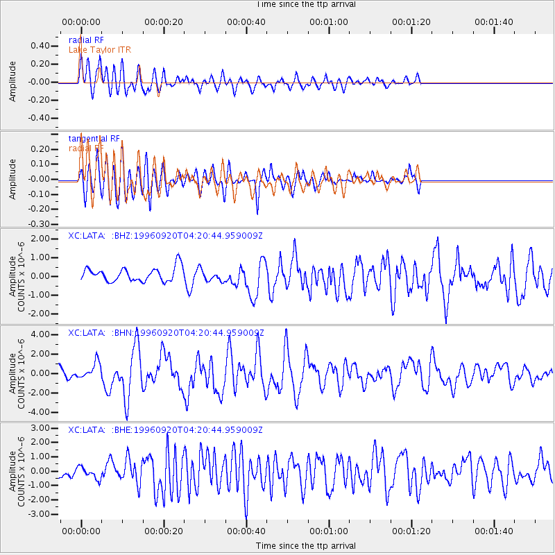
LATA Lake Taylor - Earthquake Result Viewer
*The percent match for this event was below the threshold and hence no stack was calculated.
| Earthquake location: |
Mindanao, Philippines |
| Earthquake latitude/longitude: |
9.5/126.3 |
| Earthquake time(UTC): |
1996/09/20 (264) 04:10:27 GMT |
| Earthquake Depth: |
33 km |
| Earthquake Magnitude: |
5.8 MB, 6.4 MS, 6.6 UNKNOWN, 6.6 MW |
| Earthquake Catalog/Contributor: |
WHDF/NEIC |
|
| Network: |
XC Southern Alps Passive Seismic Experiment |
| Station: |
LATA Lake Taylor |
| Lat/Lon: |
42.78 S/172.27 E |
| Elevation: |
640 m |
|
| Distance: |
66.8 deg |
| Az: |
144.823 deg |
| Baz: |
309.466 deg |
| Ray Param: |
$rayparam |
*The percent match for this event was below the threshold and hence was not used in the summary stack. |
|
| Radial Match: |
76.41551 % |
| Radial Bump: |
400 |
| Transverse Match: |
62.495243 % |
| Transverse Bump: |
400 |
| SOD ConfigId: |
4480 |
| Insert Time: |
2010-02-26 15:07:48.302 +0000 |
| GWidth: |
2.5 |
| Max Bumps: |
400 |
| Tol: |
0.001 |
|
Signal To Noise
| Channel | StoN | STA | LTA |
| XC:LATA: :BHN:19960920T04:20:44.959009Z | 1.8205057 | 8.9821793E-7 | 4.933893E-7 |
| XC:LATA: :BHE:19960920T04:20:44.959009Z | 1.3376175 | 4.1948712E-7 | 3.1360767E-7 |
| XC:LATA: :BHZ:19960920T04:20:44.959009Z | 0.773663 | 2.8226344E-7 | 3.648403E-7 |
| Arrivals |
| Ps | |
| PpPs | |
| PsPs/PpSs | |


