You are here: Home > Network List > XC95 - Southern Alps Passive Seismic Experiment Stations List
> Station LATA Lake Taylor > Earthquake Result Viewer
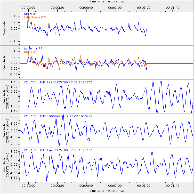
LATA Lake Taylor - Earthquake Result Viewer
*The percent match for this event was below the threshold and hence no stack was calculated.
| Earthquake location: |
Mindanao, Philippines |
| Earthquake latitude/longitude: |
9.7/126.4 |
| Earthquake time(UTC): |
1996/09/25 (269) 09:26:45 GMT |
| Earthquake Depth: |
33 km |
| Earthquake Magnitude: |
5.5 MB, 5.7 MS |
| Earthquake Catalog/Contributor: |
WHDF/NEIC |
|
| Network: |
XC Southern Alps Passive Seismic Experiment |
| Station: |
LATA Lake Taylor |
| Lat/Lon: |
42.78 S/172.27 E |
| Elevation: |
640 m |
|
| Distance: |
66.9 deg |
| Az: |
144.942 deg |
| Baz: |
309.717 deg |
| Ray Param: |
$rayparam |
*The percent match for this event was below the threshold and hence was not used in the summary stack. |
|
| Radial Match: |
42.959156 % |
| Radial Bump: |
400 |
| Transverse Match: |
61.79358 % |
| Transverse Bump: |
400 |
| SOD ConfigId: |
4480 |
| Insert Time: |
2010-02-26 15:07:50.980 +0000 |
| GWidth: |
2.5 |
| Max Bumps: |
400 |
| Tol: |
0.001 |
|
Signal To Noise
| Channel | StoN | STA | LTA |
| XC:LATA: :BHN:19960925T09:37:03.103027Z | 2.2809248 | 1.075772E-6 | 4.7163851E-7 |
| XC:LATA: :BHE:19960925T09:37:03.103027Z | 0.81363213 | 8.784104E-7 | 1.0796161E-6 |
| XC:LATA: :BHZ:19960925T09:37:03.103027Z | 1.228768 | 7.134414E-7 | 5.8061516E-7 |
| Arrivals |
| Ps | |
| PpPs | |
| PsPs/PpSs | |


