You are here: Home > Network List > IC - New China Digital Seismograph Network Stations List
> Station HIA Hailar, Neimenggu Autonomous Region, China > Earthquake Result Viewer
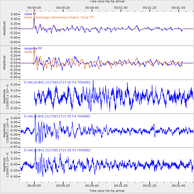
HIA Hailar, Neimenggu Autonomous Region, China - Earthquake Result Viewer
*The percent match for this event was below the threshold and hence no stack was calculated.
| Earthquake location: |
Southern Molucca Sea |
| Earthquake latitude/longitude: |
-0.2/125.2 |
| Earthquake time(UTC): |
2017/08/31 (243) 22:57:39 GMT |
| Earthquake Depth: |
47 km |
| Earthquake Magnitude: |
5.4 Mww |
| Earthquake Catalog/Contributor: |
NEIC PDE/us |
|
| Network: |
IC New China Digital Seismograph Network |
| Station: |
HIA Hailar, Neimenggu Autonomous Region, China |
| Lat/Lon: |
49.27 N/119.74 E |
| Elevation: |
620 m |
|
| Distance: |
49.6 deg |
| Az: |
355.295 deg |
| Baz: |
172.806 deg |
| Ray Param: |
$rayparam |
*The percent match for this event was below the threshold and hence was not used in the summary stack. |
|
| Radial Match: |
69.122765 % |
| Radial Bump: |
400 |
| Transverse Match: |
60.02298 % |
| Transverse Bump: |
400 |
| SOD ConfigId: |
2307692 |
| Insert Time: |
2017-09-14 23:05:31.370 +0000 |
| GWidth: |
2.5 |
| Max Bumps: |
400 |
| Tol: |
0.001 |
|
Signal To Noise
| Channel | StoN | STA | LTA |
| IC:HIA:00:BHZ:20170831T23:05:54.768988Z | 4.634962 | 3.4289923E-7 | 7.398102E-8 |
| IC:HIA:00:BH1:20170831T23:05:54.768988Z | 2.7507534 | 1.9256358E-7 | 7.000394E-8 |
| IC:HIA:00:BH2:20170831T23:05:54.768988Z | 1.1093639 | 8.387565E-8 | 7.560698E-8 |
| Arrivals |
| Ps | |
| PpPs | |
| PsPs/PpSs | |


