You are here: Home > Network List > XC95 - Southern Alps Passive Seismic Experiment Stations List
> Station MTJA Mt John > Earthquake Result Viewer
MTJA Mt John - Earthquake Result Viewer
*The percent match for this event was below the threshold and hence no stack was calculated.
| Earthquake location: |
Talaud Islands, Indonesia |
| Earthquake latitude/longitude: |
2.8/125.2 |
| Earthquake time(UTC): |
1996/03/04 (064) 15:59:05 GMT |
| Earthquake Depth: |
151 km |
| Earthquake Magnitude: |
5.8 MB, 5.9 UNKNOWN, 5.9 MW |
| Earthquake Catalog/Contributor: |
WHDF/NEIC |
|
| Network: |
XC Southern Alps Passive Seismic Experiment |
| Station: |
MTJA Mt John |
| Lat/Lon: |
43.99 S/170.46 E |
| Elevation: |
1042 m |
|
| Distance: |
61.7 deg |
| Az: |
144.371 deg |
| Baz: |
306.286 deg |
| Ray Param: |
$rayparam |
*The percent match for this event was below the threshold and hence was not used in the summary stack. |
|
| Radial Match: |
66.424446 % |
| Radial Bump: |
400 |
| Transverse Match: |
70.07407 % |
| Transverse Bump: |
400 |
| SOD ConfigId: |
4480 |
| Insert Time: |
2010-02-26 15:08:46.218 +0000 |
| GWidth: |
2.5 |
| Max Bumps: |
400 |
| Tol: |
0.001 |
|
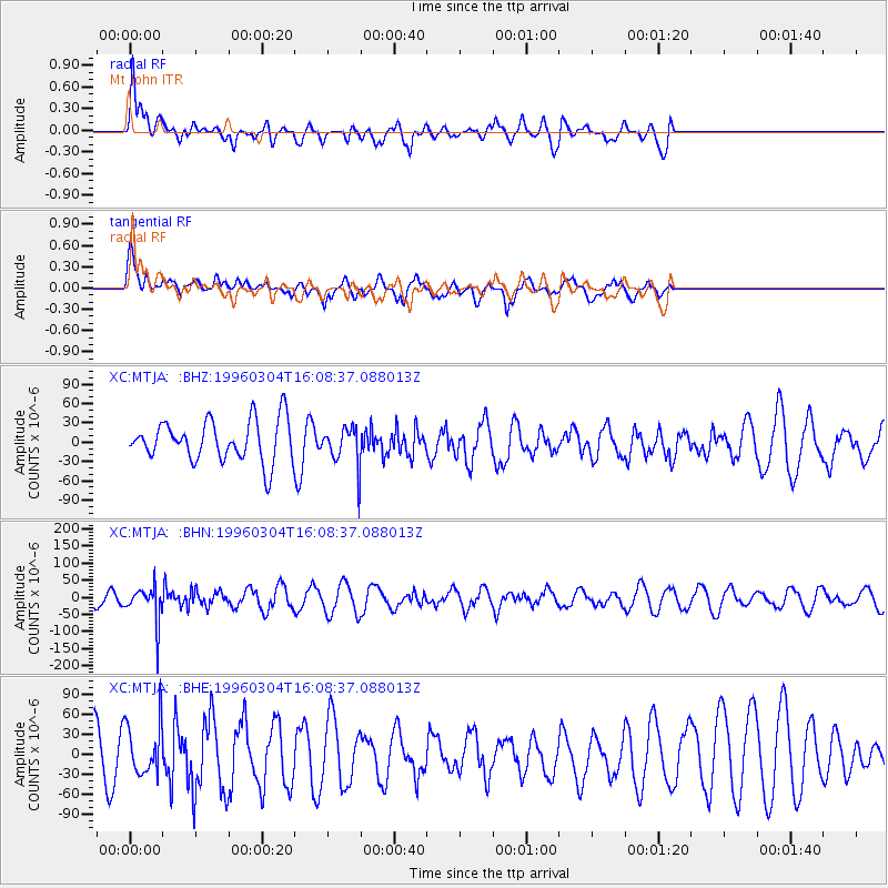
Signal To Noise
| Channel | StoN | STA | LTA |
| XC:MTJA: :BHN:19960304T16:08:37.088013Z | 2.4683647 | 5.2015326E-5 | 2.1072787E-5 |
| XC:MTJA: :BHE:19960304T16:08:37.088013Z | 0.8285564 | 3.9132112E-5 | 4.7229267E-5 |
| XC:MTJA: :BHZ:19960304T16:08:37.088013Z | 0.96029085 | 3.0264104E-5 | 3.151556E-5 |
| Arrivals |
| Ps | |
| PpPs | |
| PsPs/PpSs | |


