You are here: Home > Network List > XC95 - Southern Alps Passive Seismic Experiment Stations List
> Station MTJA Mt John > Earthquake Result Viewer
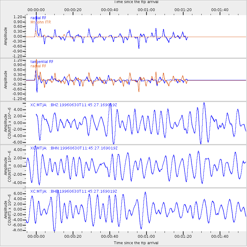
MTJA Mt John - Earthquake Result Viewer
*The percent match for this event was below the threshold and hence no stack was calculated.
| Earthquake location: |
Off East Coast Of Kamchatka |
| Earthquake latitude/longitude: |
51.7/159.8 |
| Earthquake time(UTC): |
1996/06/30 (182) 11:32:35 GMT |
| Earthquake Depth: |
33 km |
| Earthquake Magnitude: |
5.5 MB, 5.9 MS, 6.1 UNKNOWN, 6.0 MW |
| Earthquake Catalog/Contributor: |
WHDF/NEIC |
|
| Network: |
XC Southern Alps Passive Seismic Experiment |
| Station: |
MTJA Mt John |
| Lat/Lon: |
43.99 S/170.46 E |
| Elevation: |
1042 m |
|
| Distance: |
95.8 deg |
| Az: |
172.292 deg |
| Baz: |
353.364 deg |
| Ray Param: |
$rayparam |
*The percent match for this event was below the threshold and hence was not used in the summary stack. |
|
| Radial Match: |
64.6911 % |
| Radial Bump: |
317 |
| Transverse Match: |
51.61051 % |
| Transverse Bump: |
400 |
| SOD ConfigId: |
4480 |
| Insert Time: |
2010-02-26 15:08:49.843 +0000 |
| GWidth: |
2.5 |
| Max Bumps: |
400 |
| Tol: |
0.001 |
|
Signal To Noise
| Channel | StoN | STA | LTA |
| XC:MTJA: :BHN:19960630T11:45:27.169019Z | 1.8494463 | 3.0023166E-6 | 1.6233597E-6 |
| XC:MTJA: :BHE:19960630T11:45:27.169019Z | 0.6890204 | 2.3642426E-6 | 3.43131E-6 |
| XC:MTJA: :BHZ:19960630T11:45:27.169019Z | 0.8854846 | 1.4900262E-6 | 1.682724E-6 |
| Arrivals |
| Ps | |
| PpPs | |
| PsPs/PpSs | |


