You are here: Home > Network List > XC95 - Southern Alps Passive Seismic Experiment Stations List
> Station MTJA Mt John > Earthquake Result Viewer
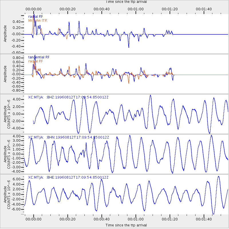
MTJA Mt John - Earthquake Result Viewer
*The percent match for this event was below the threshold and hence no stack was calculated.
| Earthquake location: |
Southern Molucca Sea |
| Earthquake latitude/longitude: |
-0.3/125.1 |
| Earthquake time(UTC): |
1996/08/12 (225) 17:00:27 GMT |
| Earthquake Depth: |
42 km |
| Earthquake Magnitude: |
5.7 MB, 5.5 MS, 6.1 UNKNOWN, 6.0 MW |
| Earthquake Catalog/Contributor: |
WHDF/NEIC |
|
| Network: |
XC Southern Alps Passive Seismic Experiment |
| Station: |
MTJA Mt John |
| Lat/Lon: |
43.99 S/170.46 E |
| Elevation: |
1042 m |
|
| Distance: |
59.3 deg |
| Az: |
143.321 deg |
| Baz: |
304.156 deg |
| Ray Param: |
$rayparam |
*The percent match for this event was below the threshold and hence was not used in the summary stack. |
|
| Radial Match: |
74.50835 % |
| Radial Bump: |
358 |
| Transverse Match: |
85.22139 % |
| Transverse Bump: |
303 |
| SOD ConfigId: |
4480 |
| Insert Time: |
2010-02-26 15:08:56.409 +0000 |
| GWidth: |
2.5 |
| Max Bumps: |
400 |
| Tol: |
0.001 |
|
Signal To Noise
| Channel | StoN | STA | LTA |
| XC:MTJA: :BHN:19960812T17:09:54.850012Z | 0.849754 | 1.7918009E-6 | 2.1086114E-6 |
| XC:MTJA: :BHE:19960812T17:09:54.850012Z | 0.55683744 | 2.1343326E-6 | 3.8329545E-6 |
| XC:MTJA: :BHZ:19960812T17:09:54.850012Z | 2.279241 | 3.6987863E-6 | 1.6228148E-6 |
| Arrivals |
| Ps | |
| PpPs | |
| PsPs/PpSs | |


