You are here: Home > Network List > XC95 - Southern Alps Passive Seismic Experiment Stations List
> Station MTJA Mt John > Earthquake Result Viewer
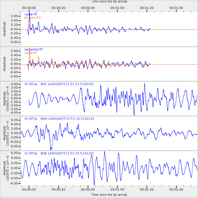
MTJA Mt John - Earthquake Result Viewer
*The percent match for this event was below the threshold and hence no stack was calculated.
| Earthquake location: |
Taiwan Region |
| Earthquake latitude/longitude: |
21.9/121.5 |
| Earthquake time(UTC): |
1996/09/05 (249) 23:42:06 GMT |
| Earthquake Depth: |
20 km |
| Earthquake Magnitude: |
6.4 MB, 6.6 MS, 6.8 UNKNOWN, 6.8 ME |
| Earthquake Catalog/Contributor: |
WHDF/NEIC |
|
| Network: |
XC Southern Alps Passive Seismic Experiment |
| Station: |
MTJA Mt John |
| Lat/Lon: |
43.99 S/170.46 E |
| Elevation: |
1042 m |
|
| Distance: |
79.4 deg |
| Az: |
146.364 deg |
| Baz: |
314.549 deg |
| Ray Param: |
$rayparam |
*The percent match for this event was below the threshold and hence was not used in the summary stack. |
|
| Radial Match: |
68.93075 % |
| Radial Bump: |
400 |
| Transverse Match: |
64.4697 % |
| Transverse Bump: |
400 |
| SOD ConfigId: |
4480 |
| Insert Time: |
2010-02-26 15:08:56.984 +0000 |
| GWidth: |
2.5 |
| Max Bumps: |
400 |
| Tol: |
0.001 |
|
Signal To Noise
| Channel | StoN | STA | LTA |
| XC:MTJA: :BHN:19960905T23:53:39.529016Z | 2.2345238 | 2.1847902E-6 | 9.777432E-7 |
| XC:MTJA: :BHE:19960905T23:53:39.529016Z | 1.2579 | 1.8101475E-6 | 1.4390233E-6 |
| XC:MTJA: :BHZ:19960905T23:53:39.529016Z | 1.0183496 | 1.0439067E-6 | 1.0250965E-6 |
| Arrivals |
| Ps | |
| PpPs | |
| PsPs/PpSs | |


