You are here: Home > Network List > XC94 - Puget Sound BB Array Stations List
> Station DOSW Dosewallips River, west > Earthquake Result Viewer
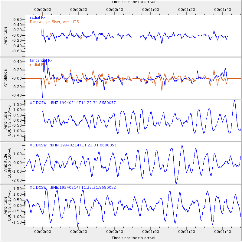
DOSW Dosewallips River, west - Earthquake Result Viewer
*The percent match for this event was below the threshold and hence no stack was calculated.
| Earthquake location: |
Near East Coast Of Kamchatka |
| Earthquake latitude/longitude: |
51.9/159.0 |
| Earthquake time(UTC): |
1994/02/14 (045) 11:14:25 GMT |
| Earthquake Depth: |
33 km |
| Earthquake Magnitude: |
5.7 MB, 5.4 MS, 5.1 UNKNOWN |
| Earthquake Catalog/Contributor: |
WHDF/NEIC |
|
| Network: |
XC Puget Sound BB Array |
| Station: |
DOSW Dosewallips River, west |
| Lat/Lon: |
47.74 N/123.02 W |
| Elevation: |
182 m |
|
| Distance: |
48.2 deg |
| Az: |
62.315 deg |
| Baz: |
305.688 deg |
| Ray Param: |
$rayparam |
*The percent match for this event was below the threshold and hence was not used in the summary stack. |
|
| Radial Match: |
59.9503 % |
| Radial Bump: |
400 |
| Transverse Match: |
67.437935 % |
| Transverse Bump: |
400 |
| SOD ConfigId: |
4480 |
| Insert Time: |
2010-02-26 15:10:40.493 +0000 |
| GWidth: |
2.5 |
| Max Bumps: |
400 |
| Tol: |
0.001 |
|
Signal To Noise
| Channel | StoN | STA | LTA |
| XC:DOSW: :BHN:19940214T11:22:31.868005Z | 0.9100043 | 6.1586076E-7 | 6.7676683E-7 |
| XC:DOSW: :BHE:19940214T11:22:31.868005Z | 2.4454308 | 9.685319E-7 | 3.9605777E-7 |
| XC:DOSW: :BHZ:19940214T11:22:31.868005Z | 1.113441 | 3.328858E-7 | 2.9897032E-7 |
| Arrivals |
| Ps | |
| PpPs | |
| PsPs/PpSs | |


