You are here: Home > Network List > XC94 - Puget Sound BB Array Stations List
> Station DOSW Dosewallips River, west > Earthquake Result Viewer
DOSW Dosewallips River, west - Earthquake Result Viewer
*The percent match for this event was below the threshold and hence no stack was calculated.
| Earthquake location: |
Southeast Of Taiwan |
| Earthquake latitude/longitude: |
22.7/123.6 |
| Earthquake time(UTC): |
1994/04/13 (103) 04:00:51 GMT |
| Earthquake Depth: |
36 km |
| Earthquake Magnitude: |
5.7 MB, 5.6 MS, 5.8 UNKNOWN |
| Earthquake Catalog/Contributor: |
WHDF/NEIC |
|
| Network: |
XC Puget Sound BB Array |
| Station: |
DOSW Dosewallips River, west |
| Lat/Lon: |
47.74 N/123.02 W |
| Elevation: |
182 m |
|
| Distance: |
87.9 deg |
| Az: |
38.322 deg |
| Baz: |
301.991 deg |
| Ray Param: |
$rayparam |
*The percent match for this event was below the threshold and hence was not used in the summary stack. |
|
| Radial Match: |
75.56941 % |
| Radial Bump: |
400 |
| Transverse Match: |
60.992504 % |
| Transverse Bump: |
400 |
| SOD ConfigId: |
4480 |
| Insert Time: |
2010-02-26 15:10:47.592 +0000 |
| GWidth: |
2.5 |
| Max Bumps: |
400 |
| Tol: |
0.001 |
|
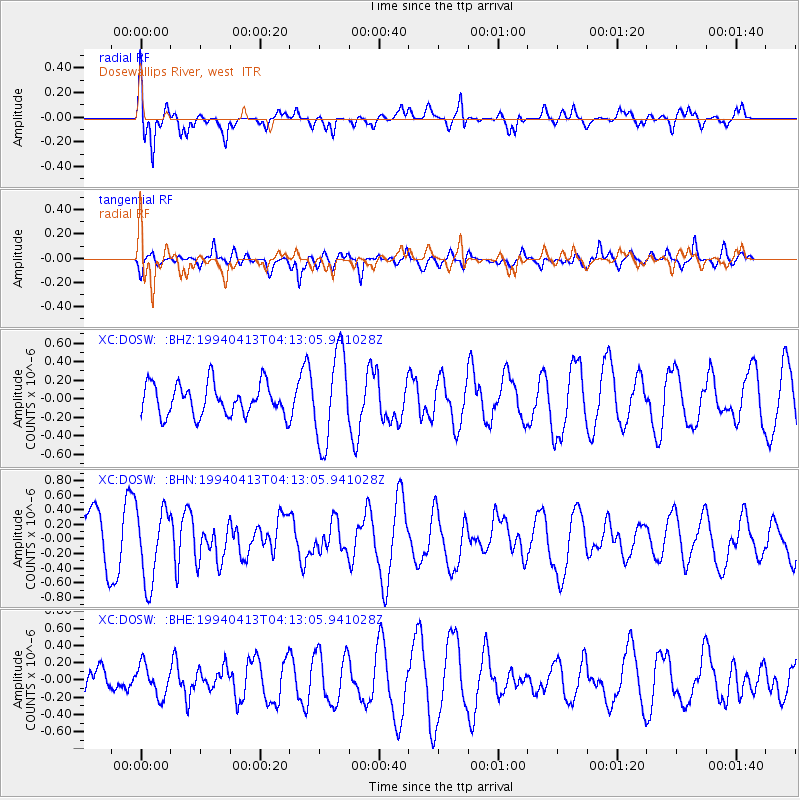
Signal To Noise
| Channel | StoN | STA | LTA |
| XC:DOSW: :BHN:19940413T04:13:05.941028Z | 1.3047479 | 4.993816E-7 | 3.8274186E-7 |
| XC:DOSW: :BHE:19940413T04:13:05.941028Z | 0.77968043 | 1.7969143E-7 | 2.3046805E-7 |
| XC:DOSW: :BHZ:19940413T04:13:05.941028Z | 2.8549197 | 4.8452665E-7 | 1.697164E-7 |
| Arrivals |
| Ps | |
| PpPs | |
| PsPs/PpSs | |


