You are here: Home > Network List > XC94 - Puget Sound BB Array Stations List
> Station DOSW Dosewallips River, west > Earthquake Result Viewer
DOSW Dosewallips River, west - Earthquake Result Viewer
*The percent match for this event was below the threshold and hence no stack was calculated.
| Earthquake location: |
Fiji Islands Region |
| Earthquake latitude/longitude: |
-21.4/-178.8 |
| Earthquake time(UTC): |
1994/04/18 (108) 21:39:43 GMT |
| Earthquake Depth: |
541 km |
| Earthquake Magnitude: |
5.5 MB |
| Earthquake Catalog/Contributor: |
WHDF/NEIC |
|
| Network: |
XC Puget Sound BB Array |
| Station: |
DOSW Dosewallips River, west |
| Lat/Lon: |
47.74 N/123.02 W |
| Elevation: |
182 m |
|
| Distance: |
85.1 deg |
| Az: |
34.084 deg |
| Baz: |
230.7 deg |
| Ray Param: |
$rayparam |
*The percent match for this event was below the threshold and hence was not used in the summary stack. |
|
| Radial Match: |
63.068356 % |
| Radial Bump: |
400 |
| Transverse Match: |
58.82281 % |
| Transverse Bump: |
400 |
| SOD ConfigId: |
4480 |
| Insert Time: |
2010-02-26 15:10:48.703 +0000 |
| GWidth: |
2.5 |
| Max Bumps: |
400 |
| Tol: |
0.001 |
|
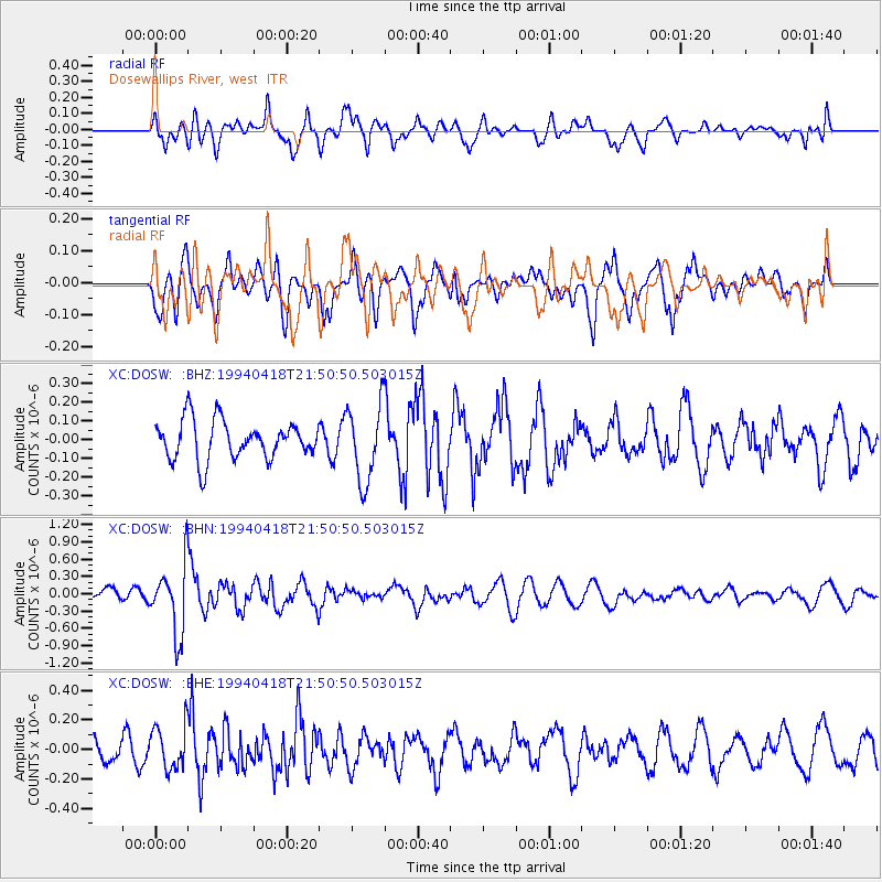
Signal To Noise
| Channel | StoN | STA | LTA |
| XC:DOSW: :BHN:19940418T21:50:50.503015Z | 3.6610322 | 5.9700363E-7 | 1.6306976E-7 |
| XC:DOSW: :BHE:19940418T21:50:50.503015Z | 2.5491002 | 1.483134E-7 | 5.818265E-8 |
| XC:DOSW: :BHZ:19940418T21:50:50.503015Z | 1.9784765 | 2.0439758E-7 | 1.0331059E-7 |
| Arrivals |
| Ps | |
| PpPs | |
| PsPs/PpSs | |


