You are here: Home > Network List > IC - New China Digital Seismograph Network Stations List
> Station HIA Hailar, Neimenggu Autonomous Region, China > Earthquake Result Viewer
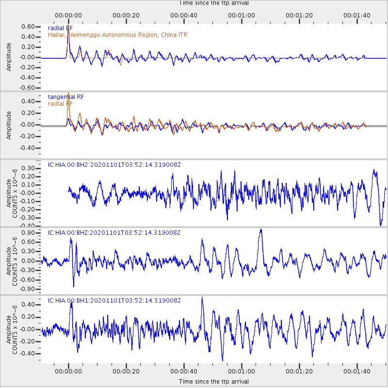
HIA Hailar, Neimenggu Autonomous Region, China - Earthquake Result Viewer
*The percent match for this event was below the threshold and hence no stack was calculated.
| Earthquake location: |
Banda Sea |
| Earthquake latitude/longitude: |
-7.1/129.2 |
| Earthquake time(UTC): |
2020/11/01 (306) 03:43:20 GMT |
| Earthquake Depth: |
181 km |
| Earthquake Magnitude: |
5.7 Mww |
| Earthquake Catalog/Contributor: |
NEIC PDE/us |
|
| Network: |
IC New China Digital Seismograph Network |
| Station: |
HIA Hailar, Neimenggu Autonomous Region, China |
| Lat/Lon: |
49.27 N/119.74 E |
| Elevation: |
620 m |
|
| Distance: |
56.7 deg |
| Az: |
352.565 deg |
| Baz: |
168.692 deg |
| Ray Param: |
$rayparam |
*The percent match for this event was below the threshold and hence was not used in the summary stack. |
|
| Radial Match: |
78.98435 % |
| Radial Bump: |
381 |
| Transverse Match: |
64.34849 % |
| Transverse Bump: |
400 |
| SOD ConfigId: |
23341671 |
| Insert Time: |
2020-11-15 04:48:11.498 +0000 |
| GWidth: |
2.5 |
| Max Bumps: |
400 |
| Tol: |
0.001 |
|
Signal To Noise
| Channel | StoN | STA | LTA |
| IC:HIA:00:BHZ:20201101T03:52:14.319008Z | 4.8819947 | 3.647191E-7 | 7.470699E-8 |
| IC:HIA:00:BH1:20201101T03:52:14.319008Z | 4.4303527 | 2.0665344E-7 | 4.6644917E-8 |
| IC:HIA:00:BH2:20201101T03:52:14.319008Z | 0.8875885 | 5.8037518E-8 | 6.5387866E-8 |
| Arrivals |
| Ps | |
| PpPs | |
| PsPs/PpSs | |


