You are here: Home > Network List > GS - US Geological Survey Networks Stations List
> Station ID05 Sulphur Canyon Road, Soda Springs, Idaho, USA > Earthquake Result Viewer
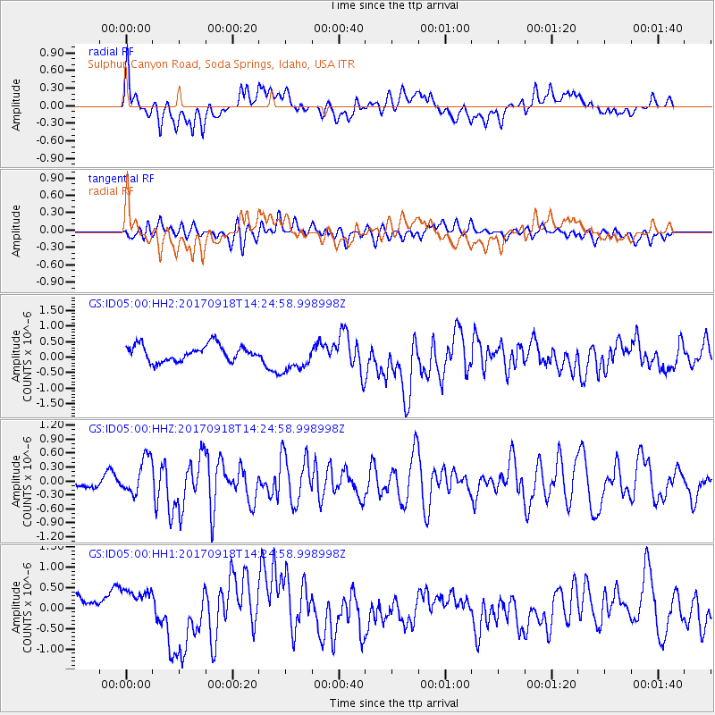
ID05 Sulphur Canyon Road, Soda Springs, Idaho, USA - Earthquake Result Viewer
*The percent match for this event was below the threshold and hence no stack was calculated.
| Earthquake location: |
Near Coast Of Oaxaca, Mexico |
| Earthquake latitude/longitude: |
15.3/-94.6 |
| Earthquake time(UTC): |
2017/09/18 (261) 14:19:12 GMT |
| Earthquake Depth: |
10 km |
| Earthquake Magnitude: |
5.6 Mww |
| Earthquake Catalog/Contributor: |
NEIC PDE/us |
|
| Network: |
GS US Geological Survey Networks |
| Station: |
ID05 Sulphur Canyon Road, Soda Springs, Idaho, USA |
| Lat/Lon: |
42.64 N/111.46 W |
| Elevation: |
2262 m |
|
| Distance: |
30.9 deg |
| Az: |
335.324 deg |
| Baz: |
146.898 deg |
| Ray Param: |
$rayparam |
*The percent match for this event was below the threshold and hence was not used in the summary stack. |
|
| Radial Match: |
57.44292 % |
| Radial Bump: |
400 |
| Transverse Match: |
49.55082 % |
| Transverse Bump: |
400 |
| SOD ConfigId: |
2341311 |
| Insert Time: |
2017-10-02 17:06:27.088 +0000 |
| GWidth: |
2.5 |
| Max Bumps: |
400 |
| Tol: |
0.001 |
|
Signal To Noise
| Channel | StoN | STA | LTA |
| GS:ID05:00:HHZ:20170918T14:24:58.998998Z | 3.4857247 | 3.9705586E-7 | 1.1390913E-7 |
| GS:ID05:00:HH1:20170918T14:24:58.998998Z | 1.2689013 | 3.7823654E-7 | 2.9808191E-7 |
| GS:ID05:00:HH2:20170918T14:24:58.998998Z | 1.8878802 | 4.8492336E-7 | 2.5686128E-7 |
| Arrivals |
| Ps | |
| PpPs | |
| PsPs/PpSs | |


