You are here: Home > Network List > GS - US Geological Survey Networks Stations List
> Station ID05 Sulphur Canyon Road, Soda Springs, Idaho, USA > Earthquake Result Viewer
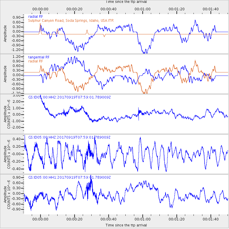
ID05 Sulphur Canyon Road, Soda Springs, Idaho, USA - Earthquake Result Viewer
*The percent match for this event was below the threshold and hence no stack was calculated.
| Earthquake location: |
Near Coast Of Oaxaca, Mexico |
| Earthquake latitude/longitude: |
15.1/-94.1 |
| Earthquake time(UTC): |
2017/09/19 (262) 07:53:13 GMT |
| Earthquake Depth: |
16 km |
| Earthquake Magnitude: |
5.5 Mww |
| Earthquake Catalog/Contributor: |
NEIC PDE/us |
|
| Network: |
GS US Geological Survey Networks |
| Station: |
ID05 Sulphur Canyon Road, Soda Springs, Idaho, USA |
| Lat/Lon: |
42.64 N/111.46 W |
| Elevation: |
2262 m |
|
| Distance: |
31.2 deg |
| Az: |
334.823 deg |
| Baz: |
146.161 deg |
| Ray Param: |
$rayparam |
*The percent match for this event was below the threshold and hence was not used in the summary stack. |
|
| Radial Match: |
55.340714 % |
| Radial Bump: |
400 |
| Transverse Match: |
42.687496 % |
| Transverse Bump: |
400 |
| SOD ConfigId: |
2341311 |
| Insert Time: |
2017-10-03 09:06:08.424 +0000 |
| GWidth: |
2.5 |
| Max Bumps: |
400 |
| Tol: |
0.001 |
|
Signal To Noise
| Channel | StoN | STA | LTA |
| GS:ID05:00:HHZ:20170919T07:59:01.789009Z | 1.331539 | 2.2685606E-7 | 1.7037132E-7 |
| GS:ID05:00:HH1:20170919T07:59:01.789009Z | 0.45798817 | 1.957413E-7 | 4.273938E-7 |
| GS:ID05:00:HH2:20170919T07:59:01.789009Z | 2.2158678 | 1.4837469E-6 | 6.696008E-7 |
| Arrivals |
| Ps | |
| PpPs | |
| PsPs/PpSs | |


