
AHQI XW.AHQI - Earthquake Result Viewer
| ||||||||||||||||||
| ||||||||||||||||||
| ||||||||||||||||||
|
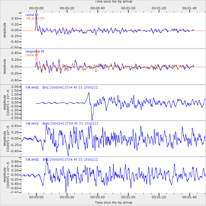
Signal To Noise
| Channel | StoN | STA | LTA |
| XW:AHQI: :BHN:20000421T04:45:33.150022Z | 2.6838107 | 1.3621425E-7 | 5.0754046E-8 |
| XW:AHQI: :BHE:20000421T04:45:33.150022Z | 3.2718036 | 2.0013738E-7 | 6.1170354E-8 |
| XW:AHQI: :BHZ:20000421T04:45:33.150022Z | 10.499863 | 5.604445E-7 | 5.3376365E-8 |
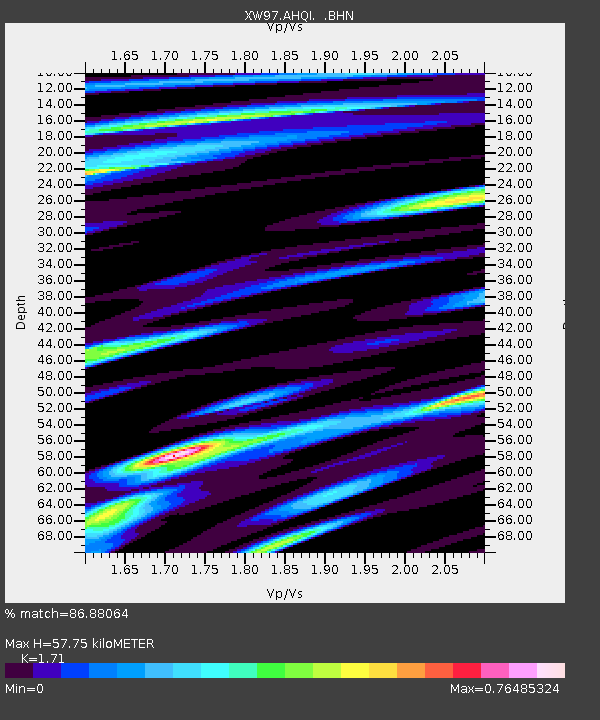
| Arrivals | |
| Ps | 6.7 SECOND |
| PpPs | 24 SECOND |
| PsPs/PpSs | 30 SECOND |

