AHQI XW.AHQI - Earthquake Result Viewer
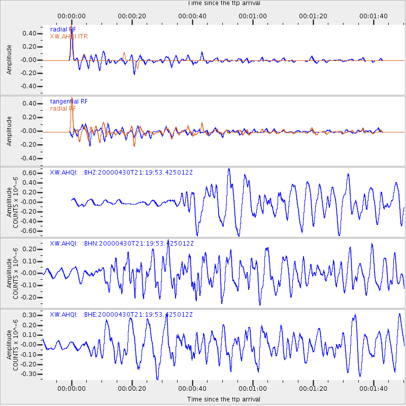
Earthquake location: Bismarck Sea
Earthquake latitude/longitude: -4.0/146.6
Earthquake time(UTC): 2000/04/30 (121) 21:08:35 GMT
Earthquake Depth: 10 km
Earthquake Magnitude: 5.3 MB, 5.7 MS, 5.9 MW, 5.9 MW
Earthquake Catalog/Contributor: WHDF/NEIC
Network: XW Tien Shan Continental Dynamics
Station: AHQI XW.AHQI
Lat/Lon: 40.93 N/78.46 E
Elevation: 1959 m
Distance: 76.3 deg
Az: 313.653 deg
Baz: 107.689 deg
Ray Param: 0.051088087
Estimated Moho Depth: 41.0 km
Estimated Crust Vp/Vs: 1.65
Assumed Crust Vp: 6.353 km/s
Estimated Crust Vs: 3.85 km/s
Estimated Crust Poisson's Ratio: 0.21
Radial Match: 88.19661 %
Radial Bump: 366
Transverse Match: 85.7759 %
Transverse Bump: 400
SOD ConfigId: 16820
Insert Time: 2010-02-26 15:13:12.018 +0000
GWidth: 2.5
Max Bumps: 400
Tol: 0.001

Signal To Noise

ChannelStoNSTALTA
XW:AHQI: :BHN:20000430T21:19:53.425012Z2.1297154.3614378E-82.0478975E-8
XW:AHQI: :BHE:20000430T21:19:53.425012Z0.79246092.7121715E-83.4224673E-8
XW:AHQI: :BHZ:20000430T21:19:53.425012Z1.0447974.138131E-83.9607038E-8
Arrivals
Ps4.3 SECOND
PpPs17 SECOND
PsPs/PpSs21 SECOND