You are here: Home > Network List > IC - New China Digital Seismograph Network Stations List
> Station HIA Hailar, Neimenggu Autonomous Region, China > Earthquake Result Viewer
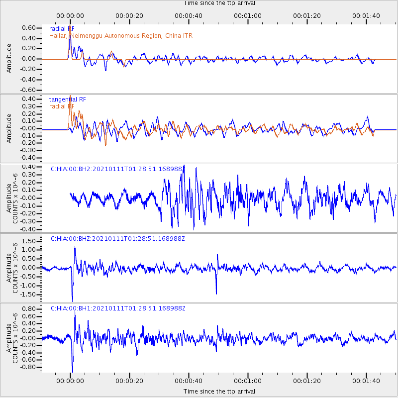
HIA Hailar, Neimenggu Autonomous Region, China - Earthquake Result Viewer
*The percent match for this event was below the threshold and hence no stack was calculated.
| Earthquake location: |
Flores Sea |
| Earthquake latitude/longitude: |
-7.2/120.5 |
| Earthquake time(UTC): |
2021/01/11 (011) 01:20:38 GMT |
| Earthquake Depth: |
618 km |
| Earthquake Magnitude: |
5.6 mww |
| Earthquake Catalog/Contributor: |
NEIC PDE/us |
|
| Network: |
IC New China Digital Seismograph Network |
| Station: |
HIA Hailar, Neimenggu Autonomous Region, China |
| Lat/Lon: |
49.27 N/119.74 E |
| Elevation: |
620 m |
|
| Distance: |
56.3 deg |
| Az: |
359.438 deg |
| Baz: |
179.149 deg |
| Ray Param: |
$rayparam |
*The percent match for this event was below the threshold and hence was not used in the summary stack. |
|
| Radial Match: |
61.386375 % |
| Radial Bump: |
400 |
| Transverse Match: |
59.238384 % |
| Transverse Bump: |
400 |
| SOD ConfigId: |
23341671 |
| Insert Time: |
2021-01-25 02:24:26.410 +0000 |
| GWidth: |
2.5 |
| Max Bumps: |
400 |
| Tol: |
0.001 |
|
Signal To Noise
| Channel | StoN | STA | LTA |
| IC:HIA:00:BHZ:20210111T01:28:51.168988Z | 6.737673 | 5.6759603E-7 | 8.4242146E-8 |
| IC:HIA:00:BH1:20210111T01:28:51.168988Z | 5.4840446 | 3.2059572E-7 | 5.845972E-8 |
| IC:HIA:00:BH2:20210111T01:28:51.168988Z | 3.0856874 | 1.643348E-7 | 5.3257114E-8 |
| Arrivals |
| Ps | |
| PpPs | |
| PsPs/PpSs | |


