You are here: Home > Network List > IC - New China Digital Seismograph Network Stations List
> Station HIA Hailar, Neimenggu Autonomous Region, China > Earthquake Result Viewer
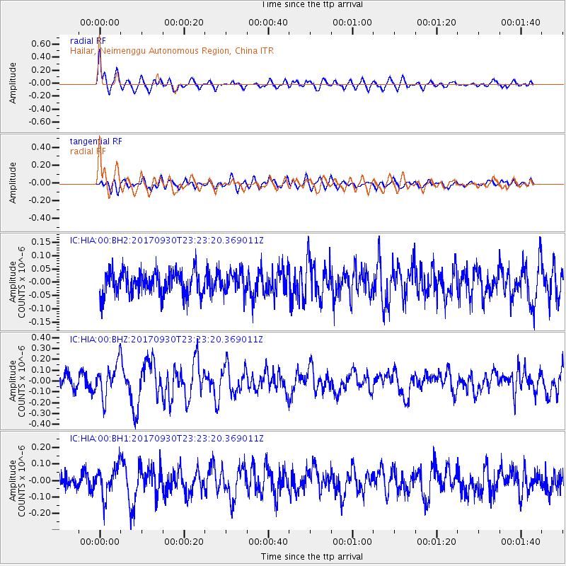
HIA Hailar, Neimenggu Autonomous Region, China - Earthquake Result Viewer
*The percent match for this event was below the threshold and hence no stack was calculated.
| Earthquake location: |
North Of Halmahera, Indonesia |
| Earthquake latitude/longitude: |
3.9/128.5 |
| Earthquake time(UTC): |
2017/09/30 (273) 23:15:29 GMT |
| Earthquake Depth: |
10 km |
| Earthquake Magnitude: |
5.5 Mww |
| Earthquake Catalog/Contributor: |
NEIC PDE/us |
|
| Network: |
IC New China Digital Seismograph Network |
| Station: |
HIA Hailar, Neimenggu Autonomous Region, China |
| Lat/Lon: |
49.27 N/119.74 E |
| Elevation: |
620 m |
|
| Distance: |
45.8 deg |
| Az: |
351.962 deg |
| Baz: |
167.703 deg |
| Ray Param: |
$rayparam |
*The percent match for this event was below the threshold and hence was not used in the summary stack. |
|
| Radial Match: |
74.182205 % |
| Radial Bump: |
400 |
| Transverse Match: |
52.034893 % |
| Transverse Bump: |
400 |
| SOD ConfigId: |
2364251 |
| Insert Time: |
2017-10-14 23:16:46.390 +0000 |
| GWidth: |
2.5 |
| Max Bumps: |
400 |
| Tol: |
0.001 |
|
Signal To Noise
| Channel | StoN | STA | LTA |
| IC:HIA:00:BHZ:20170930T23:23:20.369011Z | 2.992476 | 1.5972032E-7 | 5.337397E-8 |
| IC:HIA:00:BH1:20170930T23:23:20.369011Z | 2.2490869 | 9.0228696E-8 | 4.011792E-8 |
| IC:HIA:00:BH2:20170930T23:23:20.369011Z | 0.88445354 | 3.8427856E-8 | 4.3448136E-8 |
| Arrivals |
| Ps | |
| PpPs | |
| PsPs/PpSs | |


