
ISP GEOFON/MedNet Station Isparta, Turkey - Earthquake Result Viewer
| ||||||||||||||||||
| ||||||||||||||||||
| ||||||||||||||||||
|

Signal To Noise
| Channel | StoN | STA | LTA |
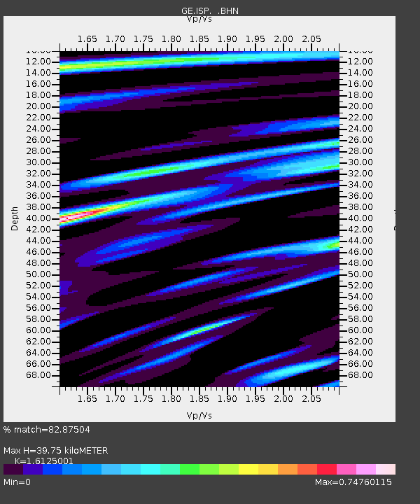
| GE:ISP: :BHN:19970720T00:42:41.790015Z | 1.679859 | 1.3408007E-7 | 7.981626E-8 |
| GE:ISP: :BHE:19970720T00:42:41.790015Z | 1.3890251 | 6.887031E-8 | 4.9581757E-8 |
| GE:ISP: :BHZ:19970720T00:42:41.790015Z | 8.946465 | 3.9965602E-7 | 4.4671953E-8 |
| Arrivals | |
| Ps | 4.0 SECOND |
| PpPs | 16 SECOND |
| PsPs/PpSs | 20 SECOND |

