You are here: Home > Network List > GS - US Geological Survey Networks Stations List
> Station ID05 Sulphur Canyon Road, Soda Springs, Idaho, USA > Earthquake Result Viewer
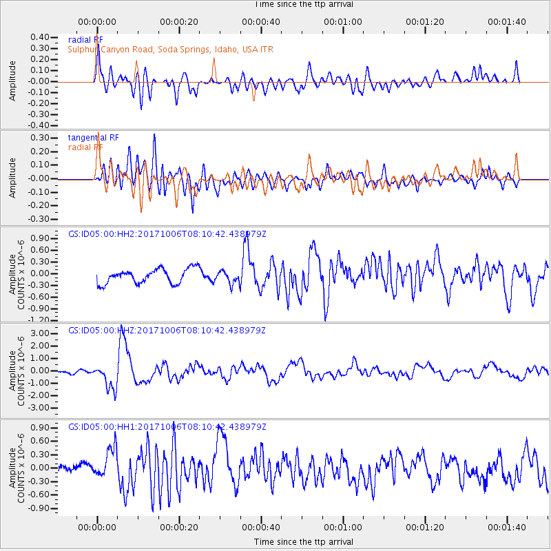
ID05 Sulphur Canyon Road, Soda Springs, Idaho, USA - Earthquake Result Viewer
*The percent match for this event was below the threshold and hence no stack was calculated.
| Earthquake location: |
Off East Coast Of Honshu, Japan |
| Earthquake latitude/longitude: |
37.5/144.0 |
| Earthquake time(UTC): |
2017/10/06 (279) 07:59:33 GMT |
| Earthquake Depth: |
10 km |
| Earthquake Magnitude: |
6.0 Mww |
| Earthquake Catalog/Contributor: |
NEIC PDE/us |
|
| Network: |
GS US Geological Survey Networks |
| Station: |
ID05 Sulphur Canyon Road, Soda Springs, Idaho, USA |
| Lat/Lon: |
42.64 N/111.46 W |
| Elevation: |
2262 m |
|
| Distance: |
74.9 deg |
| Az: |
47.71 deg |
| Baz: |
307.106 deg |
| Ray Param: |
$rayparam |
*The percent match for this event was below the threshold and hence was not used in the summary stack. |
|
| Radial Match: |
79.04604 % |
| Radial Bump: |
400 |
| Transverse Match: |
76.171555 % |
| Transverse Bump: |
400 |
| SOD ConfigId: |
2364251 |
| Insert Time: |
2017-10-20 08:02:22.495 +0000 |
| GWidth: |
2.5 |
| Max Bumps: |
400 |
| Tol: |
0.001 |
|
Signal To Noise
| Channel | StoN | STA | LTA |
| GS:ID05:00:HHZ:20171006T08:10:42.438979Z | 7.0421104 | 1.0286358E-6 | 1.4606924E-7 |
| GS:ID05:00:HH1:20171006T08:10:42.438979Z | 3.2370076 | 3.7335906E-7 | 1.153408E-7 |
| GS:ID05:00:HH2:20171006T08:10:42.438979Z | 0.87883455 | 1.6252295E-7 | 1.8493009E-7 |
| Arrivals |
| Ps | |
| PpPs | |
| PsPs/PpSs | |


