You are here: Home > Network List > IC - New China Digital Seismograph Network Stations List
> Station HIA Hailar, Neimenggu Autonomous Region, China > Earthquake Result Viewer
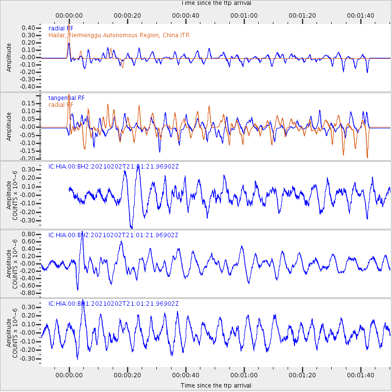
HIA Hailar, Neimenggu Autonomous Region, China - Earthquake Result Viewer
*The percent match for this event was below the threshold and hence no stack was calculated.
| Earthquake location: |
Fiji Islands |
| Earthquake latitude/longitude: |
-16.2/177.9 |
| Earthquake time(UTC): |
2021/02/02 (033) 20:49:28 GMT |
| Earthquake Depth: |
10 km |
| Earthquake Magnitude: |
5.8 Mww |
| Earthquake Catalog/Contributor: |
NEIC PDE/us |
|
| Network: |
IC New China Digital Seismograph Network |
| Station: |
HIA Hailar, Neimenggu Autonomous Region, China |
| Lat/Lon: |
49.27 N/119.74 E |
| Elevation: |
620 m |
|
| Distance: |
83.0 deg |
| Az: |
325.893 deg |
| Baz: |
124.681 deg |
| Ray Param: |
$rayparam |
*The percent match for this event was below the threshold and hence was not used in the summary stack. |
|
| Radial Match: |
39.916965 % |
| Radial Bump: |
400 |
| Transverse Match: |
43.4007 % |
| Transverse Bump: |
356 |
| SOD ConfigId: |
23341671 |
| Insert Time: |
2021-02-16 22:01:51.979 +0000 |
| GWidth: |
2.5 |
| Max Bumps: |
400 |
| Tol: |
0.001 |
|
Signal To Noise
| Channel | StoN | STA | LTA |
| IC:HIA:00:BHZ:20210202T21:01:21.96902Z | 4.43741 | 3.7493623E-7 | 8.449438E-8 |
| IC:HIA:00:BH1:20210202T21:01:21.96902Z | 1.321879 | 1.610989E-7 | 1.2187114E-7 |
| IC:HIA:00:BH2:20210202T21:01:21.96902Z | 0.93469816 | 1.2479731E-7 | 1.3351617E-7 |
| Arrivals |
| Ps | |
| PpPs | |
| PsPs/PpSs | |


