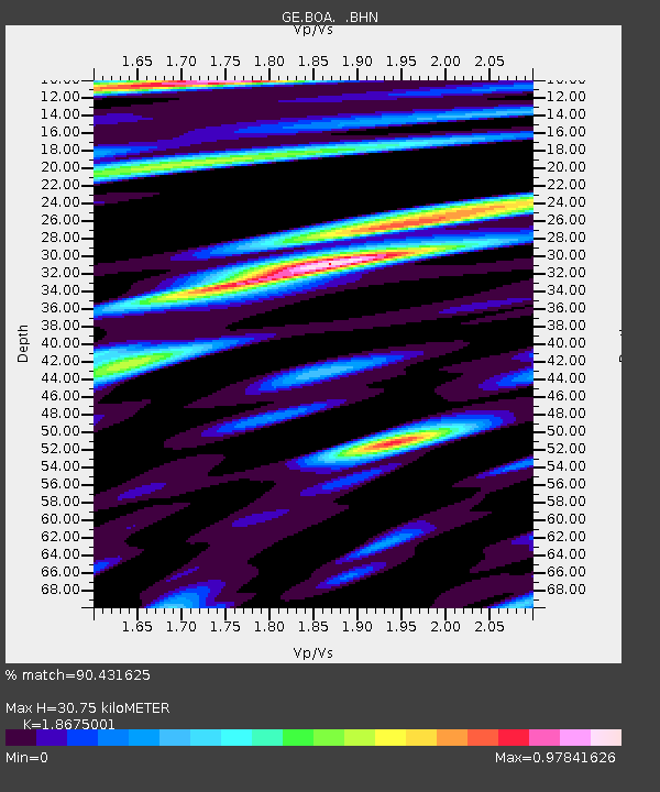
BOA GEOFON Station Boaco, Nicaragua - Earthquake Result Viewer

Earthquake location: South Sandwich Islands Region
Earthquake latitude/longitude: -57.1/-25.0
Earthquake time(UTC): 2002/12/18 (352) 14:12:21 GMT
Earthquake Depth: 10 km
Earthquake Magnitude: 5.5 MB, 6.0 MS, 6.2 MW, 5.9 MW
Earthquake Catalog/Contributor: WHDF/NEIC
Network: GE GEOFON
Station: BOA GEOFON Station Boaco, Nicaragua
Lat/Lon: 12.45 N/85.67 W
Elevation: 381 m
Distance: 85.3 deg
Az: 301.29 deg
Baz: 151.474 deg
Ray Param: 0.04484892
Estimated Moho Depth: 30.75 km
Estimated Crust Vp/Vs: 1.87
Assumed Crust Vp: 6.597 km/s
Estimated Crust Vs: 3.533 km/s
Estimated Crust Poisson's Ratio: 0.30
Radial Match: 90.431625 %
Radial Bump: 400
Transverse Match: 82.07593 %
Transverse Bump: 400
SOD ConfigId: 4714
Insert Time: 2010-03-09 05:14:37.757 +0000
GWidth: 2.5
Max Bumps: 400
Tol: 0.001

Signal To Noise

ChannelStoNSTALTA
GE:BOA: :BHN:20021218T14:24:27.367004Z2.68296773.1293825E-71.16638844E-7
GE:BOA: :BHE:20021218T14:24:27.367004Z1.27155821.6096332E-71.2658747E-7
GE:BOA: :BHZ:20021218T14:24:27.367004Z9.6654988.458415E-78.7511424E-8
Arrivals
Ps4.1 SECOND
PpPs13 SECOND
PsPs/PpSs17 SECOND